

Hoverpoint: Drone No-Fly Zones
Christian Bommersheim · Navigation
Independent analytics for this App Store listing. AppTracker is not affiliated with Christian Bommersheim.
Chart standing · US
What changed · US
Listing changes AppTracker has observed for this app in this storefront — new versions, price moves, rating shifts, and store copy.
New in 7.13: • Protected areas abroad on the map • Zones for Austria, Estonia, Norway and Ireland as areas • Official DWD severe weather warnings • Nearby subjects in “Check surroundings” • Start corner for mapping and search flights • Numbered points of interest, Google Earth tour • Smoother rain radar, next 30 min in 5-min steps • More accurate NOTAM assessment • Guided tours work again • Less heat and battery drain • Bug fixes
In-app purchases · US
What this app sells inside itself, grouped by kind and priced for this storefront.
Screenshots




Similar apps
Competitors and close alternatives, as estimated by AppTracker.
 DrohnenAtlas
Pixel & Process UG (haftungsbeschraenkt)
DrohnenAtlas
Pixel & Process UG (haftungsbeschraenkt)
 Drone Map: Airspace & Weather
YIGIT CAN TASOGLU
Drone Map: Airspace & Weather
YIGIT CAN TASOGLU
 Spot&Fly
jimenez pablo
Spot&Fly
jimenez pablo
 DroneKoll - Airspace and map
Kristoffer Nordgren
DroneKoll - Airspace and map
Kristoffer Nordgren
 Swiss DroneMap
Benjamin Koch
Swiss DroneMap
Benjamin Koch
 Drone Spot – Forecast and Map
Erwann Bestard
Drone Spot – Forecast and Map
Erwann Bestard
 Droniq TraX
Droniq GmbH
Droniq TraX
Droniq GmbH
 Drone Map & UAV Forecast
Christopher Hefferman
Drone Map & UAV Forecast
Christopher Hefferman
About
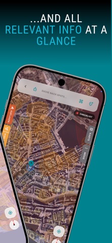
THE DRONE MAP FOR GERMANY AND EUROPE Where can I fly my drone? Hoverpoint shows geozones, no-fly zones and height limits on one map – with the official DIPUL data for Germany and official geozones for 14 European countries in total. Plus NOTAMs, weather for drone pilots and the matching rules. The core features are free and ad-free. DRONE MAP & GEOZONES • Official geozones for 14 countries: Germany (DIPUL), Austria, Switzerland, Liechtenstein, France, Belgium, Netherlands, Luxembourg, Denmark, Sweden, Norway, Estonia, Ireland and Spain • Control zones with the permitted flight height at your location, obstacles and protected areas • NOTAMs at your location – showing the notices that affect where you are • Live air traffic (ADS-B) with a warning when an aircraft or helicopter comes close (Pro) • Camera footprint, 3D view and offline maps; geozones for Germany also without coverage DRONE WEATHER • Wind and gusts at flight height, visibility, rain and Kp index – matched to your drone • Rain radar, official severe weather warnings, sun position and golden hour • 12-hour forecast for free, 7 days with Pro RULES & PERMITS • EU drone regulation and German §21h LuftVO explained, category check for your drone • Drone rules for around 140 countries and a travel check for your holiday destination • Authority finder and German flight permit application as PDF • SORA assistant, pre-flight checklists, exam trainer for A1/A3 and A2 LOGBOOK, DOCUMENTS & HANGAR • Digital flight logbook with PDF and CSV export and year in review • Import of DJI flight logs, flight analysis (Pro) and flight briefing as PDF • Documents (EFB): certificate of competence, insurance, registration, permits – with deadlines and reminders • Hangar with drone catalogue and battery management WAYPOINTS & MISSIONS • Plan waypoint missions, check them against geozones and export them for DJI, Potensic or Google Earth (Pro) • Mapping and search flights (Pro) COMMUNITY • Flight spots by pilots for pilots – with photos, 360° panoramas and geozone check • Bookmarks for your own places and pilot meetups near you WEB APP INCLUDED At web.hoverpoint.info you get the map, geozone check, weather, rules and community spots right in the browser – and with your account also logbook, documents, permits and hangar on your PC. Everything syncs with the app. HOVERPOINT PRO Map, geozones, weather, rules, logbook and community are free. Pro unlocks, among other things: live air traffic, waypoint editor and mapping, flight analysis, 7-day forecast and weather push, custom checklists, AR spotter and unlimited drones and documents. WHO IS IT FOR? • Beginners and hobby pilots (open category A1/A3) • Pilots with an EU remote pilot certificate A2 • Commercial operators: surveying, inspection, photo and film production • Drone schools, clubs and emergency teams Hoverpoint does not replace an official flight authorisation. You fly at your own responsibility under the applicable rules. An internet connection is recommended for current geozones and NOTAMs.
What's new · 7.13.0
New in 7.13: • Protected areas abroad on the map • Zones for Austria, Estonia, Norway and Ireland as areas • Official DWD severe weather warnings • Nearby subjects in “Check surroundings” • Start corner for mapping and search flights • Numbered points of interest, Google Earth tour • Smoother rain radar, next 30 min in 5-min steps • More accurate NOTAM assessment • Guided tours work again • Less heat and battery drain • Bug fixes
Details