

DrohnenAtlas
Pixel & Process UG (haftungsbeschraenkt) · Navigation
Independent analytics for this App Store listing. AppTracker is not affiliated with Pixel & Process UG (haftungsbeschraenkt).
Chart standing · US
What changed · US
Listing changes AppTracker has observed for this app in this storefront — new versions, price moves, rating shifts, and store copy.
This update makes zone answers more reliable, puts the data source credit on every surface, and brings account switching in line with data protection rules. Please note the change to logging out. ZONE CHECKS Important: Hidden map layers no longer change the answer. A zone check now always queries all dipul layers - showing or hiding a layer only affects what is drawn, not what is reported. The same applies to downloaded offline zone packs. Important: An incomplete or failed query is no longer shown as "no restrictions found" - not when tapping a point, not in the radius check, and not in border regions (CH, FR, CZ, LU, DK, SI). A restriction that was found still takes precedence; green now appears only when every source actually answered. A layer that cannot be reached is now reported as an error instead of being silently skipped. Community zones are now clearly distinguishable from official airspace (dashed outlines, a persistent notice). Fixed: tapping a circular community zone previously opened the official zone sheet. The pre-flight banner now reads "Flight possible - no restrictions found" instead of "Cleared for flight". The app does not issue clearances. SOURCE CREDIT AND LEGAL The dipul source credit is now shown by default and has been added to every surface that states a zone result: map export, briefing PDF, radius overview, spot list, and notifications. The shared pre-flight summary now carries both the source credit and the notice that it is not legal advice. When an answer comes from an installed offline zone pack, the export credits that pack's actual authority (for example BAZL/swisstopo) instead of DFS/BKG, along with the age of that download. Regulatory text (§21h conditions, zone conditions, ED-R notices) is now always shown in German regardless of app language. It quotes German law, and a translation would carry no authority. The interface itself still follows your chosen language. Legal dates in the terms, privacy policy, and wizard have been refreshed. ACCOUNT AND PRIVACY Important: Logging out and switching accounts now erase all local data belonging to the previous account - spots, flights, documents, your own checklists, widget content, and stored pre-flight checks. Previously this data stayed on the device and could end up in another account on the next login. Please sync before logging out; the app sends pending changes first where a connection is available. Downloaded map tiles are kept on logout - they are public data and matter for offline safety. They are removed when you delete your account. "Delete account" now genuinely removes everything from the device, including tracks, missions, zone packs, and the media files they referenced. Adding a second account no longer overwrites unsynced data belonging to the first. STABILITY A change rejected by the server no longer blocks all synchronisation permanently - and therefore no longer blocks account and organisation switching either. Affected entries are isolated and remain recoverable. An incorrect password no longer logs you out or deletes your stored accounts. Unrecoverable server responses now surface immediately instead of leaving a screen retrying for around 38 seconds. Malformed KML, GPX, or GeoJSON imports no longer crash the map. OTHER CHANGES The Community section (posts, pilots nearby, public profiles, spot directory) has been removed. Community-reported zones on the map remain available. Photo Planner: light windows are now shown as a timeline with a "now" marker instead of a flat list. The spot photo gallery has been redesigned with a contact-sheet strip showing capture dates and a clear close button.
In-app purchases · US
What this app sells inside itself, grouped by kind and priced for this storefront.
Screenshots





Keywords this app targets
Search terms AppTracker associates with this app — estimates, not search volume. ❝ = in the app's title; a highlighted number is its current position for that term.
Similar apps
Competitors and close alternatives, as estimated by AppTracker.
 Hoverpoint: Drone No-Fly Zones
Christian Bommersheim
Hoverpoint: Drone No-Fly Zones
Christian Bommersheim
 Droniq TraX
Droniq GmbH
1 shared topic
Droniq TraX
Droniq GmbH
1 shared topic
 Swiss DroneMap
Benjamin Koch
2 shared topics
Swiss DroneMap
Benjamin Koch
2 shared topics
 DroneKoll - Airspace and map
Kristoffer Nordgren
DroneKoll - Airspace and map
Kristoffer Nordgren
 Drone Map: Airspace & Weather
YIGIT CAN TASOGLU
Drone Map: Airspace & Weather
YIGIT CAN TASOGLU
 DroneMate
foXnoMad, LLC
1 shared topic
DroneMate
foXnoMad, LLC
1 shared topic
 Spot&Fly
jimenez pablo
1 shared topic
Spot&Fly
jimenez pablo
1 shared topic
 Drone Map & UAV Forecast
Christopher Hefferman
Drone Map & UAV Forecast
Christopher Hefferman
About
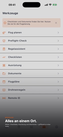
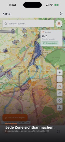
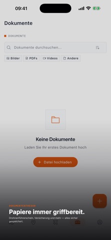
DrohnenAtlas is your comprehensive companion app for safe and compliant drone flying in Germany and Europe. FLIGHT ZONE MAP See at a glance where you are allowed to fly. The interactive map shows official DFS/DipUL geozones in real-time - control zones, ED-R restricted areas, nature reserves, and airfields. Geodata is provided by Deutsche Flugsicherung (DFS, https://www.dfs.de) and Bundesamt fuer Kartographie und Geodaesie (BKG, https://www.bkg.bund.de) via the DipUL service (https://www.dipul.de). Download map areas for offline use in the field - no mobile signal needed. MANAGE SPOTS Save your favorite flight locations with GPS coordinates, photos, and notes. Share spots with other pilots and discover new locations near you. CHECKLISTS Use pre-built checklists for various flight scenarios - Open Category, FPV Pre-flight, Near People Operations, and Winter Operations. Create runs, check off items, and document every flight without gaps. FLIGHT LOG Keep a digital flight logbook with start time, duration, drone, location, and notes. Export your flight data as CSV or PDF for insurance providers and authorities. DRONES & EQUIPMENT Manage your drones and equipment with serial numbers, maintenance logs, and NFC tag programming for quick identification in the field. DOCUMENT VAULT Securely and encrypted store important documents like insurance certificates, registrations, and permits directly on your device. RULE WIZARD Use the interactive rule wizard to determine which regulations apply to your planned flight - reach the right operating category in just a few steps. Information is based on EU Implementing Regulation 2019/947 (https://eur-lex.europa.eu/eli/reg_impl/2019/947) and the German Air Traffic Regulation (LuftVO, https://www.gesetze-im-internet.de/luftvo_2015/). OFFLINE-FIRST DrohnenAtlas works completely offline. All data is stored locally on your device. Download map areas before heading to the field. PRIVACY An account lets you sync your data across devices. All data is stored locally on your device. No data leaves your device without your consent. Anonymous usage statistics only with your explicit permission. OFFICIAL SOURCES The government information presented in this app is sourced from the following official authorities: - DipUL - Digital Platform for Unmanned Aviation: https://www.dipul.de - Deutsche Flugsicherung (DFS - German Air Navigation Services): https://www.dfs.de - Bundesamt fuer Kartographie und Geodaesie (BKG - Federal Agency for Cartography and Geodesy): https://www.bkg.bund.de - Luftfahrt-Bundesamt (LBA - Federal Aviation Office) - Drones: https://www.lba.de/DE/Drohnen/drohnen_node.html - LBA - UAS Operator Registration: https://uas-registration.lba-openuav.de/ - EU Implementing Regulation 2019/947 (consolidated incl. amendment 2024/1110): https://eur-lex.europa.eu/eli/reg_impl/2019/947 - EU Delegated Regulation 2019/945 (drone classes, Remote ID): https://eur-lex.europa.eu/eli/reg_del/2019/945 - German Air Traffic Regulation (LuftVO, as amended Dec 2025): https://www.gesetze-im-internet.de/luftvo_2015/ - EASA - Drone Rule Navigator: https://www.easa.europa.eu/en/domains/drones-air-mobility/operating-drone/drone-rule-navigator DrohnenAtlas is not affiliated with any government authority and does not replace official authorisation or legal advice. DROHNENATLAS PRO Optional subscription; the app remains free to use. Monthly: EUR 3.99 (1 month). Yearly: EUR 28.99 (12 months). Lifetime: EUR 79.00 (one-time purchase, not a subscription). Subscriptions renew automatically unless cancelled at least 24 hours before the end of the current period. Manage or cancel any time in your Apple ID settings. Terms of Use (EULA): https://www.apple.com/legal/internet-services/itunes/dev/stdeula/ Privacy Policy: https://drohnenatlas.app/privacy-policy
What's new · 2.5.3
This update makes zone answers more reliable, puts the data source credit on every surface, and brings account switching in line with data protection rules. Please note the change to logging out. ZONE CHECKS Important: Hidden map layers no longer change the answer. A zone check now always queries all dipul layers - showing or hiding a layer only affects what is drawn, not what is reported. The same applies to downloaded offline zone packs. Important: An incomplete or failed query is no longer shown as "no restrictions found" - not when tapping a point, not in the radius check, and not in border regions (CH, FR, CZ, LU, DK, SI). A restriction that was found still takes precedence; green now appears only when every source actually answered. A layer that cannot be reached is now reported as an error instead of being silently skipped. Community zones are now clearly distinguishable from official airspace (dashed outlines, a persistent notice). Fixed: tapping a circular community zone previously opened the official zone sheet. The pre-flight banner now reads "Flight possible - no restrictions found" instead of "Cleared for flight". The app does not issue clearances. SOURCE CREDIT AND LEGAL The dipul source credit is now shown by default and has been added to every surface that states a zone result: map export, briefing PDF, radius overview, spot list, and notifications. The shared pre-flight summary now carries both the source credit and the notice that it is not legal advice. When an answer comes from an installed offline zone pack, the export credits that pack's actual authority (for example BAZL/swisstopo) instead of DFS/BKG, along with the age of that download. Regulatory text (§21h conditions, zone conditions, ED-R notices) is now always shown in German regardless of app language. It quotes German law, and a translation would carry no authority. The interface itself still follows your chosen language. Legal dates in the terms, privacy policy, and wizard have been refreshed. ACCOUNT AND PRIVACY Important: Logging out and switching accounts now erase all local data belonging to the previous account - spots, flights, documents, your own checklists, widget content, and stored pre-flight checks. Previously this data stayed on the device and could end up in another account on the next login. Please sync before logging out; the app sends pending changes first where a connection is available. Downloaded map tiles are kept on logout - they are public data and matter for offline safety. They are removed when you delete your account. "Delete account" now genuinely removes everything from the device, including tracks, missions, zone packs, and the media files they referenced. Adding a second account no longer overwrites unsynced data belonging to the first. STABILITY A change rejected by the server no longer blocks all synchronisation permanently - and therefore no longer blocks account and organisation switching either. Affected entries are isolated and remain recoverable. An incorrect password no longer logs you out or deletes your stored accounts. Unrecoverable server responses now surface immediately instead of leaving a screen retrying for around 38 seconds. Malformed KML, GPX, or GeoJSON imports no longer crash the map. OTHER CHANGES The Community section (posts, pilots nearby, public profiles, spot directory) has been removed. Community-reported zones on the map remain available. Photo Planner: light windows are now shown as a timeline with a "now" marker instead of a flat list. The spot photo gallery has been redesigned with a contact-sheet strip showing capture dates and a clear close button.
Details