

Navigraph Charts
Navigraph KB · Navigation
Independent analytics for this App Store listing. AppTracker is not affiliated with Navigraph KB.
Chart standing · US
What changed · US
Listing changes AppTracker has observed for this app in this storefront — new versions, price moves, rating shifts, and store copy.
Highlights - Middle East & North Africa VFR Charts now available from Rogers Data - Best Wind now highlights the most favorable runway, and the ATIS letter is shown directly in the Flights menu - Callsigns now displayed on the map for online traffic Features - Middle East & North Africa VFR Charts provided by Rogers Data are now available - Detailed Rogers Data VFR Charts for Austria, Slovenia, and Croatia are now shown when zooming in on the map - Best Wind is now highlighted in the runway crosswind indicator, showing the most favorable runway based on current wind - The ATIS designator letter is now displayed directly in the Flights menu - Callsigns are now displayed on the map for external traffic - Runway surface type is now displayed in the runway info screen - Recent searches are now available in the Search screen Bug fixes & improvements - Improved rendering performance for online traffic - Improved search performance - Improved autoroute error handling - Improved Oceanic Tracks with waypoints displayed along each track - Fixed an issue where chart zoom and position were not restored correctly - Fixed an issue where charts displayed on the map could disappear when switching between day and night mode - Fixed an issue where certain presets showed map elements intended for a different altitude level - Fixed an issue that could cause a crash when updating map colors - Updated the underlying app framework for improved stability and compatibility
Ratings breakdown · US
The star breakdown behind this app's rating in this storefront.
In-app purchases · US
No in-app purchases.
Screenshots


About
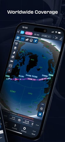
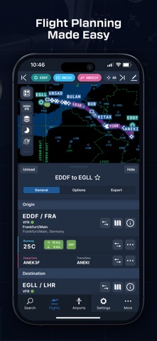
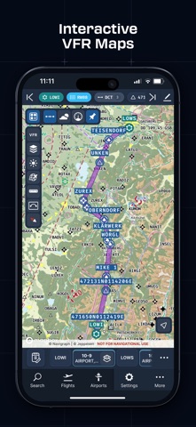
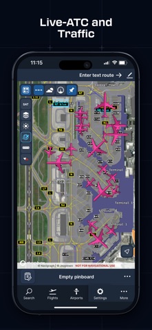
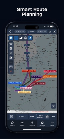
Looking for the most comprehensive software solution for flight simulation? Navigraph Charts is your co-pilot. Navigraph Charts 8 has been developed with emphasis on delivering a seamless and intuitive experience, reducing the pilot workload in all phases of the simulated flight. Why you'll always want Navigraph Charts with you in the cockpit: - Only provider of Jeppesen charts and navigation data for flight simulation. - Access to IFR chart coverage at over 7,000 airports worldwide. - Charts and data sourced from Jeppesen and updated every 28 days according to the AIRAC calendar. - Largest dataset of its kind in the world. - Most up-to-date and modern navigation software for flight simulation. - Simulator sceneries, flight plans, charts, navigation systems, and addon software are all in sync with data from the same source. - Great support. New features in Navigraph Charts 8: - Worldwide VFR Charts powered by Jeppesen VFR data - Seamless Zoom - 3D Globe Projection - Autopinning of Procedure Charts - Runway Crosswind and Airport Weather Information - Vector Charts - Weather overlays including radar and winds - ATIS - NOTAM - Annotate and draw on charts and SimBrief operational flight plan - VATSIM and IVAO traffic and ATC sector display Navigraph Unlimited features: - Moving Maps - Zoom all the way down to gate level. - 3D globe projection helps visualize Great Circle distances and polar routes. - Saves time and effort by automatically organizing relevant airport charts to pinboard. - Weather information including runway crosswinds updated in real-time. - No commitment - cancel any time you like. Moving Maps compatible with Microsoft Flight Simulator, X-Plane and Prepar3d.
What's new · 8.45.0
Highlights - Middle East & North Africa VFR Charts now available from Rogers Data - Best Wind now highlights the most favorable runway, and the ATIS letter is shown directly in the Flights menu - Callsigns now displayed on the map for online traffic Features - Middle East & North Africa VFR Charts provided by Rogers Data are now available - Detailed Rogers Data VFR Charts for Austria, Slovenia, and Croatia are now shown when zooming in on the map - Best Wind is now highlighted in the runway crosswind indicator, showing the most favorable runway based on current wind - The ATIS designator letter is now displayed directly in the Flights menu - Callsigns are now displayed on the map for external traffic - Runway surface type is now displayed in the runway info screen - Recent searches are now available in the Search screen Bug fixes & improvements - Improved rendering performance for online traffic - Improved search performance - Improved autoroute error handling - Improved Oceanic Tracks with waypoints displayed along each track - Fixed an issue where chart zoom and position were not restored correctly - Fixed an issue where charts displayed on the map could disappear when switching between day and night mode - Fixed an issue where certain presets showed map elements intended for a different altitude level - Fixed an issue that could cause a crash when updating map colors - Updated the underlying app framework for improved stability and compatibility
Details