

Fishing Spots Near Me: Tides
Mijanur Rahman · Lifestyle
Independent analytics for this App Store listing. AppTracker is not affiliated with Mijanur Rahman.
Chart standing · US
What changed · US
Listing changes AppTracker has observed for this app in this storefront — new versions, price moves, rating shifts, and store copy.
Smarter bite rating with wind, solunar times and pressure Weather card, marine alerts and a catch log Next tide countdown on your Lock Screen Pro: fishing spots nearby, fish scanner, waves, rivers and nautical charts
Screenshots




About
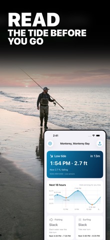
Fishing Spots Near Me puts 3,400+ NOAA coastal stations on a map near you and tells you in one word whether it is a good time to fish there: Prime, Fair or Slack. Tap any spot for its tides, live water temperature, wind and current. NO ADS. NO ACCOUNT. The basics are free. Pro is a monthly or yearly plan, or one Lifetime payment if you never want a subscription. FREE FEATURES • Map of every NOAA coastal station, with the 2 spots nearest to you free • Search by town, beach, pier or bay • Bite rating for every spot: Prime, Fair or Slack • Next high and low tide with a live countdown • 16-hour tide curve with heights, daylight band and sunrise/sunset marks. Hold and drag to read any time • Today and tomorrow tide table • Sunrise, sunset and moon phase • Home Screen widget and Apple Watch app • Times shown in the spot's own time zone. Dark mode. Works offline with the last saved data FISHING SPOTS PRO • Every spot on the map, and unlimited saved spots • 7-day tide table and 30-day calendar with the month's biggest highs and lowest lows marked • Best bite windows: the exact hours when the rating is Prime • Live water temperature, wind and observed water level from the nearest NOAA sensors • Tidal current speed, direction and the next slack window • Tide alerts: a notification 15 min to 2 hours before any high or low tide • Full 24-hour tide curve • Lock Screen widgets and Apple Watch complications WHY OBSERVED WATER LEVEL MATTERS Predictions can miss by a foot in wind or storm surge. The app shows the predicted height and the real sensor reading side by side. Data: NOAA CO-OPS (tidesandcurrents.noaa.gov). US coastal stations only. Ratings are estimates based on tide flow, wind and daylight. Not for navigation. TERMS AND PRIVACY Terms of Use: https://mrsoftit.com/fishingspotfinder/terms Privacy Policy: https://mrsoftit.com/fishingspotfinder/privacy
What's new · 1.1
Smarter bite rating with wind, solunar times and pressure Weather card, marine alerts and a catch log Next tide countdown on your Lock Screen Pro: fishing spots nearby, fish scanner, waves, rivers and nautical charts
Details