

Cronoscopio: Italy Then & Now
Giorgio Di Falco · Travel
Independent analytics for this App Store listing. AppTracker is not affiliated with Giorgio Di Falco.
Chart standing · US
What changed · US
Listing changes AppTracker has observed for this app in this storefront — new versions, price moves, rating shifts, and store copy.
In-app purchases · US
No in-app purchases.
Screenshots





About
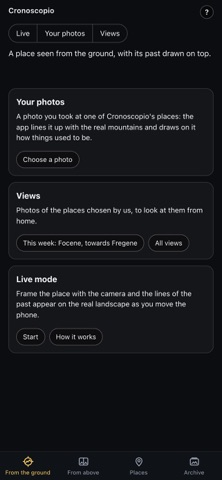
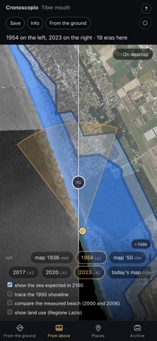
It doesn't tell you what you're looking at. It tells you what is no longer there. Cronoscopio is about Italy only: it sets today's Italian landscape beside yesterday's. From the ground, on a photo of the place — or on what you frame with the camera — it draws how far the glacier reached, where the shoreline ran, where the landslide came down. From above, it puts aerial photos from two eras side by side with a slider you drag: 1954 against today, the forest before and after the storm, the city growing. FROM THE GROUND • Views of the places chosen and lined up by us, to look at even from home. • Your photos: if you took it at one of Cronoscopio's places, the app lines it up with the real mountains and draws on it how things used to be. • Live: frame the ridges against the sky and the lines of the past appear on the landscape, locked to the outline of the mountains. FROM ABOVE • Public aerial photos of all of Italy from 1988 to 2012, beside today's map; where the Regions publish them, also 1954 and recent years. • Historical maps dated from their content, back to the nineteenth-century cadastre. • At the places: glacier outlines year by year, shorelines, dunes, the sea expected in 2100, the Regions' land use. THIRTY PLACES, AND WHY THEY'RE THERE Glaciers — the Marmolada, the Forni, the Lys, the Miage, the Adamello. Coasts — Comacchio, the Po Delta, the Poetto, the Tiber mouth, the Scala dei Turchi. Lakes and rivers — the bell tower of Curon in Lago di Resia, the Vajont. Events — the Amatrice earthquake, the Faenza flood, the Morandi bridge, the Carezza forest flattened by storm Vaia. Each place says why it's there and what to look for. These are the first thirty: the list will grow over time. WITH THE SOURCES IN VIEW Everything comes from Italian public data — ministries, Regions, provinces, research institutes — and every screen says where it comes from, with its licence, and what is our own estimate. The snapshots you save carry the source written into them. Place names stay in Italian, as on the road signs. OFFLINE, NO ACCOUNT Download a place before you set off and it works even where there's no signal. No account, no advertising, no tracking: your location is used on the phone and never sent. FREE AND FULL VERSION Free: the comparison of aerial photos anywhere in Italy, land use, the big screen on a computer, and six selected places with three years each; the place you are in, however, you see in full. The full version, a one-time purchase, opens all the places, all the years, the historical maps and the download of any place, and includes the new places and new maps of Italy we will add. No subscription. In English and Italian.
What's new · 1.1
Cronoscopio now speaks English: the whole app, the guide and the cards of every place. The language follows your phone, and you can change it in the Archive. Live aerial photos load faster when a national service is down.
Details