

MapifyIt Survey
Mapifyit LLC · Business
Independent analytics for this App Store listing. AppTracker is not affiliated with Mapifyit LLC.
Chart standing · US
Screenshots


About
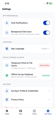
MapifyIt Survey helps fiber-network field teams capture, organize, and submit OFC infrastructure data directly from the field. Use a live GIS map to record network assets such as manholes, joint closures, cabinets, poles, cable routes, and survey boundaries. Capture accurate coordinates, complete project-specific asset forms, attach photo evidence, and submit structured GeoJSON data to your organization’s network platform. Designed for telecom surveyors, technicians, and GIS teams, MapifyIt Survey keeps fieldwork organized even where connectivity is limited. Capture work offline, store it securely on the device, and automatically synchronize queued records when a connection is available. Key features: - Capture point assets, cable routes, and polygon boundaries on a GIS map - Record cable routes using live GPS tracking or manual drawing - Add asset attributes, conditions, fiber details, installation notes, and more - Attach photo evidence to field submissions - Work offline with a local submission queue and automatic sync - View assigned projects, survey tasks, and work orders - Track field progress, pending submissions, approvals, and survey activity - Receive task and review notifications - Use GPS accuracy indicators to improve the quality of captured data - Support OTDR test sign-off and premise-assessment workflows MapifyIt Survey gives field teams a faster, more reliable way to create an accurate, living record of optical-fiber infrastructure.
Details