

EmberStrike: Wildfire Map
LEIGH JOELYNN · Lifestyle
Independent analytics for this App Store listing. AppTracker is not affiliated with LEIGH JOELYNN.
Chart standing · US
Screenshots


About
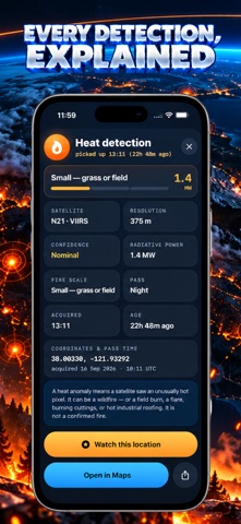
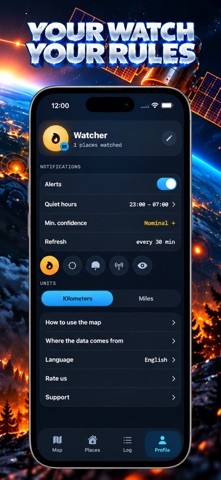
Satellite data on where it's actually burning, centered on the places you care about. EmberStrike pulls active fire detections from satellite passes and shows them on a map around your home, your cabin, or a route you're about to drive. Mark a point, set an alert radius, and the app tells you when a new hotspot shows up inside it — distance, direction, and how fresh the detection is. Every detection is exactly that: a satellite heat reading, not a confirmed fire. It could be a wildfire, a controlled burn, or a false positive. The app says so plainly and points you to the confidence rating on every hotspot. WHAT'S INSIDE Live satellite hotspots, color-coded by how recent they are Alert radius around any saved point — home, cabin, or a custom spot Route checking across up to five points at once A log of every new hotspot near your points, with distance and time Fire danger forecast layer for Europe, a day ahead Offline access to the last data pulled, clearly dated This is not an emergency alert system. For an active fire, always confirm through your local fire authority — EmberStrike just gets you the satellite picture faster than waiting for someone else to post it.
Details