

Tailwaters: Dam Flows
Johnny Bates · Sports
Independent analytics for this App Store listing. AppTracker is not affiliated with Johnny Bates.
Chart standing · US
What changed · US
Listing changes AppTracker has observed for this app in this storefront — new versions, price moves, rating shifts, and store copy.
Dam front view showing which units are running, spillway gates, and the Norfork siphon. Weather now uses the nearest station observation. Flow times now show the clock time the water rises and falls at every access. Named shoals, holes, islands and bluffs on every river map, more sponsor placements, and SWPA's schedule phone line. New features now reach the app as soon as they are released.
Ratings breakdown · US
The star breakdown behind this app's rating in this storefront.
Screenshots



About
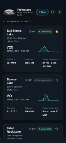
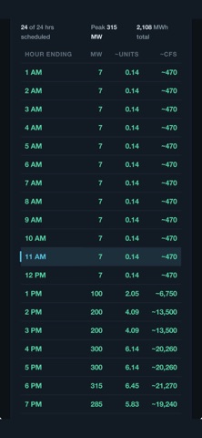
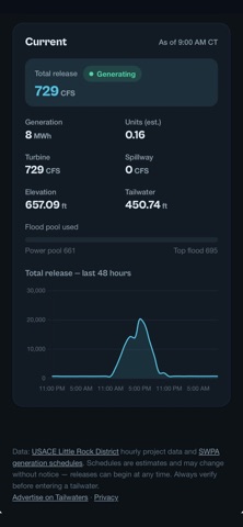
Know before you go. Tailwaters shows live water releases, hydropower generation schedules, and river conditions for all five White River Basin Dams — Beaver, Table Rock, Bull Shoals, Norfork, and Greers Ferry. LIVE CONDITIONS Total CFS, lake elevation, and tailwater levels, updated hourly Generating or not-generating status at a glance Today's generation schedule with hour-by-hour releases, megawatts, and estimated CFS RIVER ACCESS MAPS Boat ramps, wade access, shoals, and catch-and-release zones Regulation notes for each reach so you know the rules before you fish WEATHER ON THE WATER Current conditions and a 12-hour hourly forecast for every tailwater Animated NOAA rain radar BUILT FOR ANGLERS Star your favorite Dams and they sort to the top Generation alerts when a dam starts or stops releasing Dark and light themes, designed for one-handed use on the water Data comes straight from the U.S. Army Corps of Engineers, Southwestern Power Administration, and the National Weather Service. Schedules are estimates and can change without notice — always verify conditions before entering a tailwater.
What's new · 1.0.11
Dam front view showing which units are running, spillway gates, and the Norfork siphon. Weather now uses the nearest station observation. Flow times now show the clock time the water rises and falls at every access. Named shoals, holes, islands and bluffs on every river map, more sponsor placements, and SWPA's schedule phone line. New features now reach the app as soon as they are released.
Details