

US Tide Charts - Marevia
kota tada · Weather
Independent analytics for this App Store listing. AppTracker is not affiliated with kota tada.
Chart standing · US
What changed · US
Listing changes AppTracker has observed for this app in this storefront — new versions, price moves, rating shifts, and store copy.
Improved stability and support for the latest iOS. Fixed issues with ads and subscriptions.
In-app purchases · US
What this app sells inside itself, grouped by kind and priced for this storefront.
Screenshots


About
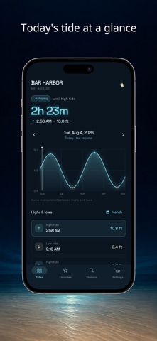
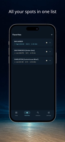
Marevia is a tide chart app for the US coast. It covers more than 3400 stations and shows high and low tide times, tide heights and the daily tide curve. A full year ahead, with no day limit Move freely to any date up to a year out, not just today. Plan a trip or a fishing day months in advance. Three ways to find a station Search by name or state code, browse the map, or sort by distance from where you are. Location access is optional, and search and the map still reach every station without it. All your spots in one list Save the places you check often and see the next high or low tide for each of them at a glance. Tide alerts Choose how many minutes before a high or low tide you want to be notified, and pick the days of the week. Times are never converted Every time shown is the local time at the station exactly as issued, including daylight saving. Nothing is shifted to your device time zone, so nothing drifts by an hour. Display settings Switch tide height between ft and m, and time between 12-hour and 24-hour. Take your data with you Export your saved places and settings as a JSON file at any time. About Premium High and low tide times stay open to everyone. Premium removes the banner, lifts the limits on saved places and alerts, adds a monthly view of a whole month at once, and shows the six-minute interval curve where the station supports it. Coverage Covers the coasts of the continental US, Alaska, Hawaii and the territories. Tides outside those areas are not supported. Made for fishing, surfing, tide pooling, clamming, kayaking and coastal photography. Terms of Use (EULA): https://show-ec09e.web.app/terms.html Privacy Policy: https://show-ec09e.web.app/privacy.html Terms of Use (EULA): https://show-ec09e.web.app/terms.html Privacy Policy: https://show-ec09e.web.app/privacy.html
What's new · 1.0.2
Improved stability and support for the latest iOS. Fixed issues with ads and subscriptions.
Details