

GPS Area Measure - FieldAcre
Sonal Sojitra · Utilities
Independent analytics for this App Store listing. AppTracker is not affiliated with Sonal Sojitra.
Chart standing · US
What changed · US
Listing changes AppTracker has observed for this app in this storefront — new versions, price moves, rating shifts, and store copy.
Price & rating history · US
Reconstructed from the listing changes AppTracker has observed in this storefront. A field is charted once it has changed more than once, and each line starts at the value it moved from.
Average rating · ★ 0.00 now · 2 changes on record
Ratings breakdown · US
The star breakdown behind this app's rating in this storefront.
Screenshots



About
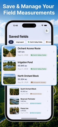
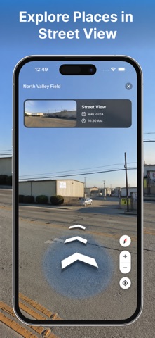
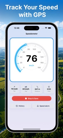
Measure land, fields, farms, and property boundaries with confidence using AcreMap. Whether you manage farmland, plan a property project, inspect rural land, or need quick measurements on the go, AcreMap gives you practical mapping tools in one place. KEY FEATURES • Area Measurement Drop points around a boundary to calculate field and property areas, including perimeter details. • Distance Measurement Measure paths, roads, boundaries, and routes with accurate distance results. • Multiple Measurement Tools Use area, distance, circle, compass, and location-based tools for different surveying needs. • Satellite and Map Views Switch between map styles to understand terrain, land boundaries, roads, and surrounding features. • Street View Exploration Preview locations and inspect roads, fields, and properties with Street View. • GPS Coordinates View and work with precise location coordinates while measuring. • Save and Organize Save measurements for later and organize fields and properties into groups. • Edit Saved Measurements Open saved measurements, review details, update information, and manage your measurement library. • Export Your Work Export measurement data and map information for sharing, documentation, and future reference. • Speedometer Track your current speed while driving, walking, or moving around a property. HOW IT WORKS • Tap to measure – Drop points on a satellite or hybrid map to outline any plot and get its area instantly. • Walk to measure – Use GPS to record boundary points as you walk the perimeter of a field. • Street View – Drop into Google Street View to scout land and roads up close. AcreMap is designed for quick estimates and practical field planning. Measurements should not be used as a substitute for professional surveying or legal property documentation. SPEAKS YOUR LANGUAGE Available in 18 languages, with full metric and imperial support. ACREMAP PRO Unlock the full experience with AcreMap Pro: • Unlimited saved fields • Export to PDF, GPX, KML & CSV • Custom field pin colors • Detailed PDF field reports AcreMap Pro is available as a weekly, monthly, or annual subscription, plus a one-time lifetime option. Payment is charged to your Apple ID at confirmation of purchase. Subscriptions renew automatically unless auto-renew is turned off at least 24 hours before the end of the current period. Manage or cancel anytime in your App Store account settings. Download AcreMap and make land measurement simpler, clearer, and more accessible. Terms of Use: https://acremap.blogspot.com/2026/08/terms-of-use.html Privacy Policy: https://acremap.blogspot.com/2026/08/privacy-policy.html
What's new · 1.1
• Fixed bugs and improved stability Thank you for using the app. If you enjoy it or have ideas for improvement, please leave a review, your feedback helps us make it better.
Details