

OceanPulse: Marine Navigation
OceanPulse LLC · Navigation
Independent analytics for this App Store listing. AppTracker is not affiliated with OceanPulse LLC.
Chart standing · US
What changed · US
Listing changes AppTracker has observed for this app in this storefront — new versions, price moves, rating shifts, and store copy.
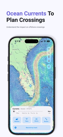
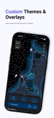
We added advanced weather data overlays directly on the chart. The wind overlay allows you to visualize wind direction and speed from the latest GFS forecast. The waves overlay shows significant wave height, period, and direction. Tap any location the chart to see detail wave forecasts for an exact location. The currents overlay shows ocean currents, useful for any offshore activity to see how your route will be impacted. The radar overlay uses high resolution data from MSMR from NOAAs National Severe Storm Lab and covers the entire US, including Alaska, Hawaii, Guam, parts of southern Canada, and portions of the Caribbean. Weather data is refreshed rapidly from official sources. Also new in this version is the tap & hold shortcut to quick view weather, measure distance, or create a marker for any location.
Ratings breakdown · US
The star breakdown behind this app's rating in this storefront.
Screenshots




About
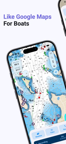
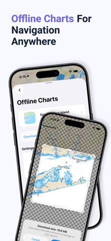
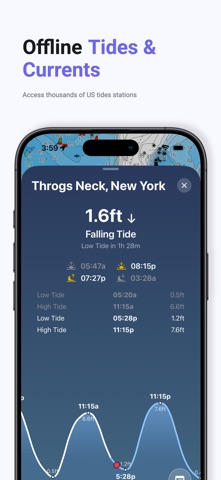
OceanPulse turns your iPhone and iPad into a full marine chartplotter. Navigate with real NOAA nautical charts, plan routes, record your voyages, and check tides, currents, and marine weather — even miles offshore with no cell signal. Whether you sail, fish, cruise, or paddle, OceanPulse puts everything you need on the water in one beautifully simple app. REAL NAUTICAL CHARTS • Detailed NOAA vector charts with buoys, beacons, lights, wrecks, landmarks, and depth soundings • Tap anything on the chart for a plain-English description of every nautical object under your finger • Depth shading plus a safety-depth layer that hatches water shallower than your chosen depth in red • Bridge clearance labels, light sectors, and depths in feet, meters, or fathoms • Light, dark, and auto themes with road or satellite land overlays OFFLINE CHARTS • Download any region — frame it on the chart and see the exact size before you commit • Downloads continue in the background and resume automatically if interrupted • Update badges tell you when newer charts are available • Only-offline mode shows exactly where you have coverage — no surprises offshore ROUTE PLANNING & NAVIGATION • Tap to drop waypoints, drag to fine-tune — legs redraw live and everything autosaves • Total distance, per-leg distance and bearing, ETA, and estimated fuel burn from your boat's cruise speed • Navigate a route with live distance, bearing, and ETA to the next waypoint — reverse direction anytime TIDES & CURRENTS • Worldwide tide and current predictions computed on your device — no internet required • Interactive tide graphs with highs, lows, slack water, and sun and moon times • Station icons on the chart show rising or falling conditions at a glance, up to 100 years ahead MARINE WEATHER • Wind speed, direction, and gusts, swell height, period, and direction, temperature, clouds, and precipitation • Detailed 3-hourly forecast grid plus a week-ahead outlook for any point you tap on the chart TRACK RECORDING • Record your voyage with live speed, distance, and time — pause and resume anytime • Live Activity keeps your stats on the Lock Screen and Dynamic Island • Review speed graphs and stats for every saved track, then share as a photo or GPX file MARINAS & ANCHORAGES • Marina and anchorage details powered by Waterway Guides: fuel, dockside depth, VHF channel, holding, and wind protection • The Nearby view surfaces marinas, anchorages, and tide stations within 10 nautical miles of your boat WAYPOINTS, GPX & SYNC • Drop custom markers with names, notes, colors, and icons — or enter exact coordinates in DD, DDM, or DMS • Import and export GPX waypoints, routes, and tracks to and from any other app or chartplotter • iCloud sync keeps your waypoints, routes, tracks, and boat profile up to date on all your devices BUILT FOR THE HELM • GPS follow and course-up modes with a projected course line, plus live speed and heading readouts • Caliper tool measures distance and bearing between any two points on the chart • One search for places, marinas, anchorages, tide stations, and your own waypoints, routes, and tracks • Snap a photo of your boat and OceanPulse estimates its specs to set up your vessel profile in seconds Perfect for sailing, fishing, powerboating, coastal cruising, kayaking, and offshore passages — from your home harbor to waters you've never explored. Read the EULA at https://www.apple.com/legal/internet-services/itunes/dev/stdeula/
What's new · 2.0.0
We added advanced weather data overlays directly on the chart. The wind overlay allows you to visualize wind direction and speed from the latest GFS forecast. The waves overlay shows significant wave height, period, and direction. Tap any location the chart to see detail wave forecasts for an exact location. The currents overlay shows ocean currents, useful for any offshore activity to see how your route will be impacted. The radar overlay uses high resolution data from MSMR from NOAAs National Severe Storm Lab and covers the entire US, including Alaska, Hawaii, Guam, parts of southern Canada, and portions of the Caribbean. Weather data is refreshed rapidly from official sources. Also new in this version is the tap & hold shortcut to quick view weather, measure distance, or create a marker for any location.
Details