

LandMap: Property Line Finder
LEAN ASIA CO., LTD · Navigation
Independent analytics for this App Store listing. AppTracker is not affiliated with LEAN ASIA CO., LTD.
Chart standing · US
What changed · US
Listing changes AppTracker has observed for this app in this storefront — new versions, price moves, rating shifts, and store copy.
First release of LandMap. Find property lines, identify parcels, and measure land area and perimeter with GPS.
Ratings breakdown · US
The star breakdown behind this app's rating in this storefront.
In-app purchases · US
What this app sells inside itself, grouped by kind and priced for this storefront.
Screenshots






About
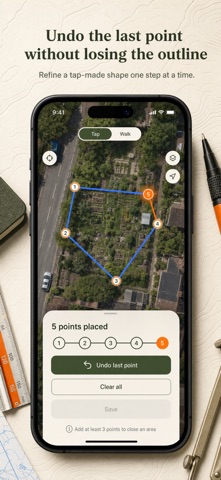
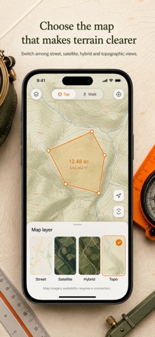
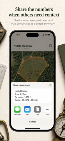
How big is that piece of land, really? Open the satellite map, tap the corners of the plot — or press Start and walk the boundary with the phone in your pocket — and the acreage is on screen: acres, hectares, square feet, or square meters. LandMap measures on the real curved Earth, not on flat screen pixels — spherical geodesic math tuned so a 40-acre field reads as 40 acres, not 40.09. If your outline crosses itself, LandMap tells you instead of showing a number that is quietly wrong. And when the land has no signal, the measuring still works. WHAT YOU GET • Tap the four corners of a lot and the acreage is on screen before you put the phone away • Walk a fence line hands-free — GPS recording keeps running with the screen off and stops the second you tap Stop • Perimeter and distance next to every area, so a fencing or paving quote is one walk away • Satellite, Street, Hybrid, and USGS Topo layers — switch mid-measurement without losing your outline • Every saved plot waits in your Watchlist and reopens on the map exactly where you left it • The same field flips between acres, hectares, m², and ft² with one tap — no converting by hand PERFECT FOR • Farmers totalling planting and pasture area field by field • Land buyers checking what a “half-acre lot” actually measures before making an offer • Fence, paving, and landscaping contractors quoting area and perimeter on site • Hunters and rural land scouts sizing up terrain on the topo layer before walking in WHY NOT JUST USE A REGULAR MAPS APP? A maps app shows you the land, but it cannot tell you its size. LandMap puts the measuring on top of the same familiar satellite view: tap the corners, read the acreage. No surveyor’s wheel, no pacing it out, no guessing from the listing. PRIVATE BY DEFAULT Your measurements and saved plots live in a database on your phone — no account, no cloud, nothing leaves the device. Location is used only to center the map and record your walk, and recording stops the moment you tap Stop. FULL ACCESS LandMap Pro unlocks the whole app: tap measuring, GPS boundary walking, all four map layers including USGS Topo, unlimited saved plots, and every unit. Choose a weekly subscription, a yearly subscription, or a one-time lifetime purchase — all three unlock the same full toolkit. Stand on the first corner, press Start, and walk the line — by the time you are back, the acreage is waiting. Terms of Use: https://leanstudio.asia/terms-of-use Privacy Policy: https://leanstudio.asia/privacy-policy Support: support@leanstudio.asia
What's new · 1.1
First release of LandMap. Find property lines, identify parcels, and measure land area and perimeter with GPS.
Details