

TrailMapper: GPX Routes
Ziga Porenta · Navigation
Independent analytics for this App Store listing. AppTracker is not affiliated with Ziga Porenta.
Chart standing · US
What changed · US
Listing changes AppTracker has observed for this app in this storefront — new versions, price moves, rating shifts, and store copy.
Know more about your route, and never lose your way. NEW • Off-route alerts: feel and hear a heads-up when you stray from your route. Choose the distance in Settings. • Steepness colors: see climbs and descents on the map, from flat green to very steep red. • Steepest climb and descent are now shown on the route card. • Points of interest: waypoints in your GPX files now appear as pins on the map and in a list. • Units: choose metric, imperial, or follow your device. • Open GPX files straight from Files, Mail, or the share sheet. IMPROVED • Editing a saved route now lets you move and delete individual points. • Reversing a route is now saved, so it stays reversed when you reopen or export it. • Renaming a route keeps the rest of your original GPX file intact. • Elevation gain and loss are more realistic, with small bumps no longer counted. • Better elevation loading on long routes. • Routes now fit the screen with proper padding when opened. • GPX files that use planned routes (rte) now import. FIXED • Undo while a road-snapped segment was loading could break the route. • A failed save no longer discards the route you just drew. • Your route library is recovered automatically if its index gets damaged.
In-app purchases · US
No in-app purchases.
Screenshots




Similar apps
Competitors and close alternatives, as estimated by AppTracker.





About
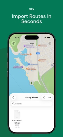
Import GPX files, create your own routes, and understand the terrain before you go. TrailMapper is a focused route-mapping app for runners, hikers, walkers, travelers, and GPX users who want a clear place to keep and inspect their routes. Plan a new route by tapping waypoints on the map, import GPX tracks from Files, save favorites to your route library, and open them again whenever you need them. TrailMapper shows distance, estimated time, elevation gain and loss, min/max/average elevation, and an interactive route profile so you can understand the path ahead. Key features: - Import GPX and XML route files - Create routes directly on the map - Snap walking routes to roads and paths - Save routes to your personal library - Review distance, estimated time, and elevation stats - Inspect an interactive elevation profile - Follow your current position and heading - Compare your location with the active route - Reverse, edit, rename, delete, export, and share GPX routes - Switch map styles for different planning needs How it works: 1. Import a GPX file or create a new route on the map. 2. Review the route, distance, elevation, and estimated time. 3. Save, follow, export, or edit the route whenever you need it. TrailMapper is built for personal route workflows, not social feeds or crowded trip-planning dashboards. Keep your GPX routes organized, readable, and ready for the next walk, hike, or outdoor day. Download TrailMapper and start mapping your GPX routes.
What's new · 1.0.1
Know more about your route, and never lose your way. NEW • Off-route alerts: feel and hear a heads-up when you stray from your route. Choose the distance in Settings. • Steepness colors: see climbs and descents on the map, from flat green to very steep red. • Steepest climb and descent are now shown on the route card. • Points of interest: waypoints in your GPX files now appear as pins on the map and in a list. • Units: choose metric, imperial, or follow your device. • Open GPX files straight from Files, Mail, or the share sheet. IMPROVED • Editing a saved route now lets you move and delete individual points. • Reversing a route is now saved, so it stays reversed when you reopen or export it. • Renaming a route keeps the rest of your original GPX file intact. • Elevation gain and loss are more realistic, with small bumps no longer counted. • Better elevation loading on long routes. • Routes now fit the screen with proper padding when opened. • GPX files that use planned routes (rte) now import. FIXED • Undo while a road-snapped segment was loading could break the route. • A failed save no longer discards the route you just drew. • Your route library is recovered automatically if its index gets damaged.
Details