

Latitude and Longitude Finder
Alper Sumer Guc · Reference
Independent analytics for this App Store listing. AppTracker is not affiliated with Alper Sumer Guc.
Chart standing · US
What changed · US
Listing changes AppTracker has observed for this app in this storefront — new versions, price moves, rating shifts, and store copy.
• New: Altimeter! See your altitude live, with the most accurate reading from the barometer, GPS or terrain model. • Track air pressure plus your total ascent and descent. • Minor improvements and bug fixes.
Price & rating history · US
Reconstructed from the listing changes AppTracker has observed in this storefront. A field is charted once it has changed more than once, and each line starts at the value it moved from.
Average rating · ★ 4.79 now · 20 changes on record
Ratings breakdown · US
The star breakdown behind this app's rating in this storefront.
In-app purchases · US
No in-app purchases.
Screenshots




About
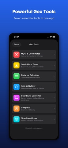
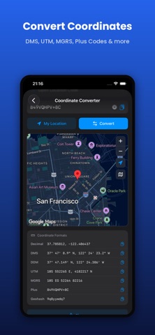
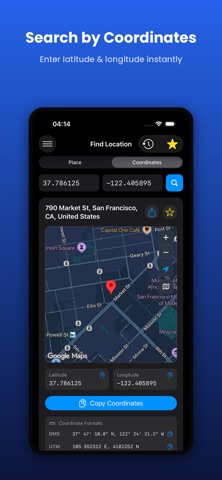
LatLong is a powerful yet simple tool designed for searching locations worldwide, converting between coordinate formats, and viewing them on the map. FEATURES - Worldwide place name search - Address from coordinates (reverse geocoding) - Tap anywhere on the map to get coordinates - 4 coordinate formats: Decimal, DMS, UTM, MGRS - 3 map providers: Apple Maps, Google Maps, OpenStreetMap - Standard, Satellite, and Hybrid map layers - Favorites and recent searches history - One-tap location sharing - 8 language support - Light, Dark, and System theme options - One-tap copy for all formats WHO IS IT FOR? - Sailors, pilots, and travelers - GIS professionals and map experts - Geography students and educators - Search and rescue teams - Professional and casual users alike ACCURACY UTM and MGRS calculations use WGS84 datum. Special UTM zone rules for Norway and Svalbard regions are supported. THE LATLONG.NET MOBILE APP Carry the power of the trusted latlong.net website in your pocket. Works smoothly with an internet connection, is free, and continuously improved. Terms of Use (EULA): https://www.apple.com/legal/internet-services/itunes/dev/stdeula/ Privacy Policy: https://www.latlong.net/privacy.php
What's new · 3.0.3
• New: Altimeter! See your altitude live, with the most accurate reading from the barometer, GPS or terrain model. • Track air pressure plus your total ascent and descent. • Minor improvements and bug fixes.
Details