

SeaState
Tom Curry · Weather
Independent analytics for this App Store listing. AppTracker is not affiliated with Tom Curry.
Chart standing · US
What changed · US
Listing changes AppTracker has observed for this app in this storefront — new versions, price moves, rating shifts, and store copy.
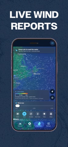
Two big additions to the chart, and a cleaner map underneath them. TIDE STATIONS ON THE CHART NOAA tide stations are plotted as orange diamonds. Tap one for a 24-hour tide curve with the next high and low, and whether the water is rising or falling right now. WIND, 48 HOURS AHEAD Drag the new time scrubber to watch the wind field move through the next two days. Find the window before it closes. A CLEARER CHART • Apple Maps is now the default base map, with the NOAA chart as a one-tap overlay • Every layer — Chart, Wind, Current, Sea Temp and Tides — is now a button on the map instead of buried in a menu • The wind scale was rebuilt around 0–25 kts, the range that actually matters for small craft, and the overlay is lighter so you can see the water underneath • Map icons are smaller and easier to tell apart, and AIS labels from a connected receiver now read straight across instead of sideways SIMPLER The chlorophyll, wave height and wave period map layers have been retired. Sea temperature and currents remain — they're the layers that actually find fish.
Ratings breakdown · US
The star breakdown behind this app's rating in this storefront.
In-app purchases · US
What this app sells inside itself, grouped by kind and priced for this storefront.
Screenshots

Keywords this app targets
Search terms AppTracker associates with this app — estimates, not search volume. ❝ = in the app's title; a highlighted number is its current position for that term.
Similar apps
Competitors and close alternatives, as estimated by AppTracker.
 Marine Weather and Tides
Anton Nikitin
1 shared topic
Marine Weather and Tides
Anton Nikitin
1 shared topic
 FishWeather: Marine Forecasts
WeatherFlow
1 shared topic
FishWeather: Marine Forecasts
WeatherFlow
1 shared topic
 Nautide: Tides, Wind, Waves +
Igoox
2 shared topics
Nautide: Tides, Wind, Waves +
Igoox
2 shared topics
 TideWise: NOAA Tides & Charts
Trevor Daniel
1 shared topic
TideWise: NOAA Tides & Charts
Trevor Daniel
1 shared topic
 NOAA Marine Weather & Forecast
ZipoApps
1 shared topic
NOAA Marine Weather & Forecast
ZipoApps
1 shared topic
 Coastal 360 Pro
Angler U, LLC
Coastal 360 Pro
Angler U, LLC
 SeaLegs AI
SeaLegs LLC
1 shared topic
SeaLegs AI
SeaLegs LLC
1 shared topic
 TidesPro: Tide Charts & Tables
ASR Concepts LLC
1 shared topic
TidesPro: Tide Charts & Tables
ASR Concepts LLC
1 shared topic
About
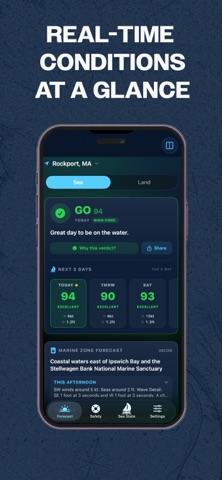
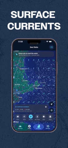
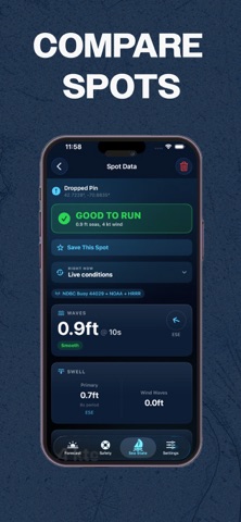
No guessing games, no scrolling through ten weather apps. Swipe the 7-day outlook for peak wind and wave height at a glance, then drill into hourly wind a full week out with gusts, true direction and Beaufort scale. The official NWS marine zone forecast comes straight from the source, written in plain English, free for every user. No subscription wall between you and the forecast that actually matters. See the whole picture on the chart. Toggle official NOAA ENC charts over Apple Maps for depth soundings, buoys and hazards at three detail levels, cached for when you lose signal offshore. Animated wind and current particle layers show you what's actually moving out there. Drag the time scrubber through the next 48 hours and watch conditions shift before you leave the dock. Tide stations are now plotted right on the chart. Tap any station for a 24-hour tide curve with the next high and low, so you can time the cut or the flat right. Have an AIS receiver aboard? Connect your boat's NMEA Wi-Fi gateway to see live depth, wind, water temperature and nearby vessel traffic on the chart, working offshore with no cell signal. Dropping the hook? Anchor Watch guards your position with a drag alarm and two-fix false-alarm protection, backed by Live Activity, Dynamic Island and Apple Watch alerts. Sleep easier. For the fishing crowd, sea surface temperature and current layers help you find the edges and breaks where fish stack up. SeaState is built for offshore anglers, cruisers, sailors, surfers and captains who want a straight answer, not a maybe. Download it and know before you go. SEASTATE PRO Unlock the full experience with SeaState Pro, available as monthly ($4.99) or yearly ($39.99) auto-renewing subscriptions, or a one-time lifetime purchase. Subscriptions automatically renew unless cancelled at least 24 hours before the end of the current period. Manage or cancel anytime in your Apple ID account settings. Terms of Use (EULA): https://www.apple.com/legal/internet-services/itunes/dev/stdeula/ Privacy Policy: https://docs.google.com/document/d/e/2PACX-1vSY_MSMhZzNRZdRyUTLIYg2dysB6Yoo6szTZNGo12tEjolM4JxnRZflKeW21fHNcxzNn92tfcueboMY/pub
What's new · 1.7.0
Two big additions to the chart, and a cleaner map underneath them. TIDE STATIONS ON THE CHART NOAA tide stations are plotted as orange diamonds. Tap one for a 24-hour tide curve with the next high and low, and whether the water is rising or falling right now. WIND, 48 HOURS AHEAD Drag the new time scrubber to watch the wind field move through the next two days. Find the window before it closes. A CLEARER CHART • Apple Maps is now the default base map, with the NOAA chart as a one-tap overlay • Every layer — Chart, Wind, Current, Sea Temp and Tides — is now a button on the map instead of buried in a menu • The wind scale was rebuilt around 0–25 kts, the range that actually matters for small craft, and the overlay is lighter so you can see the water underneath • Map icons are smaller and easier to tell apart, and AIS labels from a connected receiver now read straight across instead of sideways SIMPLER The chlorophyll, wave height and wave period map layers have been retired. Sea temperature and currents remain — they're the layers that actually find fish.
Details