

NYC Intel: Safety & Crime Map
Dmytro Polokhalo · Utilities
Independent analytics for this App Store listing. AppTracker is not affiliated with Dmytro Polokhalo.
Chart standing · US
What changed · US
Listing changes AppTracker has observed for this app in this storefront — new versions, price moves, rating shifts, and store copy.
Faster My Block loading and smoother scrolling, with cached results when switching locations. Crime trends now use a clearly labeled 500 m radius and the latest available NYPD data. Improved alert schedules, transit details, and notification links. Updated NYC Block Check branding.
Price & rating history · US
Reconstructed from the listing changes AppTracker has observed in this storefront. A field is charted once it has changed more than once, and each line starts at the value it moved from.
Average rating · ★ 4.59 now · 11 changes on record
Ratings breakdown · US
The star breakdown behind this app's rating in this storefront.
Screenshots



Keywords this app targets
Search terms AppTracker associates with this app — estimates, not search volume. ❝ = in the app's title; a highlighted number is its current position for that term.
Similar apps
Competitors and close alternatives, as estimated by AppTracker.


About
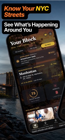
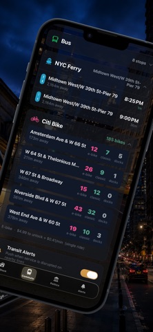
NYC Block Check is an independent guide to public information around a New York City address. It is not affiliated with, endorsed by, or operated by the City of New York, NYPD, MTA, New York State, or any government agency. It does not provide official government services or emergency dispatch. Check parking rules and street-cleaning schedules, subway and bus service, trash and recycling collection, 311 service requests, building and housing records, inspections, crashes, local events, and other neighborhood information in one place. Save the places that matter to you and choose which alerts you want to receive. The map and address reports organize records from NYC Open Data and responsible agencies, including NYC 311, DOT, DOF, NYPD, HPD, DOB, DOHMH, DSNY, NYC Public Schools, and NYC Emergency Management. Transit information comes from MTA; traffic and camera information comes from 511NY. Other identified sources include Citi Bike/Lyft, OpenStreetMap, and the National Weather Service. News cards identify their publisher and link to the original article. NYC Block Check creates its own summaries, categories, comparisons, and countdowns from cited records. These are informational estimates, not official government findings. Public data can be delayed, incomplete, or revised; a complaint or request does not prove an outcome. Check time-sensitive details with the linked original source. Call 911 for emergencies and 311 for official NYC services. Full source links are available in Settings → Sources & Independence. Privacy Policy: https://nycintel.app/app-privacy Terms of Use: https://nycintel.app/app-terms
What's new · 1.8.16
Faster My Block loading and smoother scrolling, with cached results when switching locations. Crime trends now use a clearly labeled 500 m radius and the latest available NYPD data. Improved alert schedules, transit details, and notification links. Updated NYC Block Check branding.
Details