

HeatMark: Fire Tracker
Epic Genius LLC · Navigation
Independent analytics for this App Store listing. AppTracker is not affiliated with Epic Genius LLC.
Chart standing · US
What changed · US
Listing changes AppTracker has observed for this app in this storefront — new versions, price moves, rating shifts, and store copy.
Minor Bug Fixes
Ratings breakdown · US
The star breakdown behind this app's rating in this storefront.
Screenshots





About
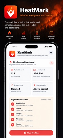
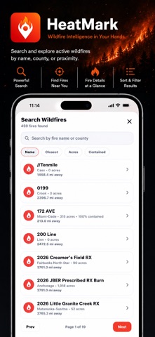
HeatMark is a powerful wildfire tracking app that lets you monitor active fires in real time using NASA satellite data, advanced map overlays, and live weather conditions. Whether you live in a wildfire-prone area, travel frequently, manage property, or simply want better awareness during fire season, HeatMark provides professional-grade fire intelligence in a clean, easy-to-use interface. LIVE WILDFIRE MAP View active wildfire detections powered by NASA FIRMS satellite data. See fire hotspots update as new satellite passes detect thermal anomalies. ADVANCED SATELLITE LAYERS Switch between multiple detection sources including MODIS and VIIRS for different resolution views. Toggle map layers to customize how you analyze fire activity. GROWTH RINGS Visualize how wildfire detections expand over time with growth ring overlays. Quickly understand fire progression and direction. SMOKE AND RADAR OVERLAYS Overlay live radar and atmospheric layers to monitor smoke movement and weather conditions impacting fire spread. LIVE WIND CONDITIONS See current wind speed and direction to better understand potential fire movement near your location. SAVED LOCATIONS Add and save cities or use your current GPS location to quickly jump back to areas you care about. Set a default location for instant access on launch. WATCHLIST MONITORING Track specific areas and receive fast visibility into nearby fire activity. MAP PROVIDER OPTIONS Choose between Apple Maps or Google Maps on supported devices for the mapping experience you prefer. SMART LEGEND CONTROLS Collapse and expand the map legend to maximize viewing space while keeping powerful tools easily accessible. FAST AND RESPONSIVE HeatMark is built for performance. Pan, zoom, and explore fire layers smoothly even when monitoring large geographic regions. WHO HEATMARK IS FOR • Homeowners in wildfire-prone regions • Travelers monitoring fire activity near destinations • Outdoor enthusiasts and RV travelers • Property managers and landowners • Anyone who wants clear, real-time wildfire visibility DATA SOURCES Wildfire detections are provided by NASA FIRMS satellite data. Weather overlays use trusted meteorological sources to deliver accurate wind and radar information. IMPORTANT HeatMark is designed for awareness and monitoring. It is not an official emergency alert system. Always follow guidance from local authorities during wildfire events. Stay informed. Stay aware. Track wildfire activity with precision using HeatMark.
What's new · 1.2
Minor Bug Fixes
Details