

Mountain Identifier: Peakr
Ideas All Day Ltd. · Reference
Independent analytics for this App Store listing. AppTracker is not affiliated with Ideas All Day Ltd.
Chart standing · US
What changed · US
Listing changes AppTracker has observed for this app in this storefront — new versions, price moves, rating shifts, and store copy.
Version 1.2.1 improves trust, privacy, and reliability. Identification and follow-up answers use clearer likely-match language, route and safety details now emphasize current official verification, and location disclosures explain when data is sent and saved. Native review requests appear only after successful identification milestones, analytics is event-only, and the release excludes development keys, test purchase files, and showcase data.
Price & rating history · US
Reconstructed from the listing changes AppTracker has observed in this storefront. A field is charted once it has changed more than once, and each line starts at the value it moved from.
Average rating · ★ 3.14 now · 2 changes on record
In-app purchases · US
What this app sells inside itself, grouped by kind and priced for this storefront.
Screenshots


About
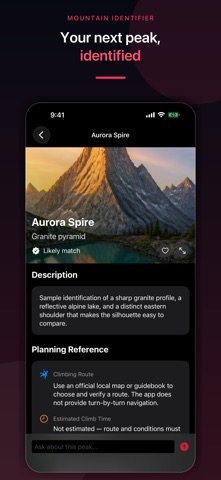
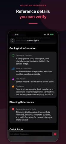
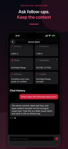
Identify a mountain from a photo, compare nearby peaks with Look Around, and keep a personal collection of summits you have climbed, planned, or saved for later. IDENTIFY PEAKS FROM PHOTOS • Take a photo or choose an image from your library • Add optional location context to narrow nearby candidates • Review a likely peak name, elevation, range, geology, and reference details • Save useful matches to your personal collection LOOK AROUND • Point your camera toward the horizon to view nearby peak labels • Compare names, elevations, directions, and distances using location, compass, and OpenStreetMap data • Treat labels as orientation aids and verify them with an official map BUILD YOUR PEAK COLLECTION • Mark summits as Climbed, Planned, or Wishlist • Sort and revisit saved identifications • Review saved records offline when available • Sync saved items through your private iCloud database when iCloud is enabled ASK FOLLOW-UP QUESTIONS Explore general geology, history, and route context for a saved peak. AI-generated answers can be incomplete, outdated, or wrong. The app does not provide live weather, avalanche, volcanic, closure, permit, rescue, or trail conditions. PRIVACY AND AI Only photos, optional location, and questions you choose to analyze are sent through a developer-operated proxy to service providers for app functionality. Saved results can include the photo and capture location and may sync through your private iCloud database. Aptabase and Superwall process limited product, device, and purchase data for analytics and subscriptions. Peak names, photos, coordinates, chat text, and raw AI responses are not intentionally attached to analytics events. The app does not use this data for advertising tracking. Mountain and peak identification is a likely visual match, not a verified fact. Do not use the app as your only map, navigation, route, weather, avalanche, emergency, or safety source. Check current official local sources and qualified guidance before any outdoor activity. Introductory or periodic free credits may be available. An optional auto-renewing subscription may provide additional or unlimited identification access. Current price, billing period, trial availability, and terms appear in Apple's purchase sheet before confirmation. Terms of Use (EULA): https://www.apple.com/legal/internet-services/itunes/dev/stdeula/
What's new · 1.2.1
Version 1.2.1 improves trust, privacy, and reliability. Identification and follow-up answers use clearer likely-match language, route and safety details now emphasize current official verification, and location disclosures explain when data is sent and saved. Native review requests appear only after successful identification milestones, analytics is event-only, and the release excludes development keys, test purchase files, and showcase data.
Details