

Compass Altimeter: Sun & Moon
Fuzhou Knock Dream Technology Co., Ltd. · Navigation
Independent analytics for this App Store listing. AppTracker is not affiliated with Fuzhou Knock Dream Technology Co., Ltd.
Chart standing · US
What changed · US
Listing changes AppTracker has observed for this app in this storefront — new versions, price moves, rating shifts, and store copy.
Improved altitude accuracy. Barometric altitude is now calibrated only from a stable GPS fix, so a weak first signal no longer throws the reading off. Until calibration completes, the app asks you to step outdoors instead of showing an unreliable estimate. Also includes reliability improvements.
Ratings breakdown · US
The star breakdown behind this app's rating in this storefront.
In-app purchases · US
What this app sells inside itself, grouped by kind and priced for this storefront.
Screenshots




About
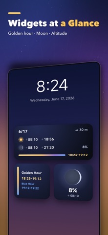
Compass Altimeter is a clean, pro‑grade altitude and compass tool that fuses GPS with (iOS) barometer/absolute altitude for faster, more accurate live readings—ideal for hiking, exploration, landscape photography, and stargazing. Key Features • Live altitude: GPS + barometric fusion with accuracy readout • Relative altitude: set a base point to track ascent/descent • Compass: True/Magnetic North, localized direction text (NESW), subtle haptics • Calibration & interference: magnetic interference detection with calibration tips • Sun & Moon: elevation/azimuth, sunrise/sunset and moonrise/moonset • Photography aide: golden/blue hour with bearings for better framing • Coordinates: switch between Decimal and DMS; one‑tap copy • Sources & accuracy: Auto/GPS/Barometric modes; GPS High/Medium/Low accuracy • Pressure: live pressure with units (hPa/mmHg/inHg/psi) • Personalization: m/ft, 12/24‑hour, language, precision display, splash animation Design & Performance • Large, legible typography with modern UI • “Fast‑then‑precise” positioning and smart lifecycle for stability and battery savings Use Cases • Hiking and outdoor exploration • Landscape photography timing (golden/blue hour) • Astronomy and education • Travel logging and altitude lookup Privacy & Permissions • Location while in use only; used for altitude and sun/moon calculations (no continuous background tracking) • Motion/Barometer (iOS) improves altitude accuracy • Preferences stored on device; no personal data uploaded Disclaimer • Measurements depend on environment/device and are for reference only ------------------------------------------------------- Compass Altimeter Subscription Service Introduction: 【Premium Membership Features】 - Red light eye protection display for night use - Display measurement precision information - Display environmental magnetic field data in real-time - New restricted features to be added in the future Subscription Options: - Monthly: $1.99/month - Yearly: $9.99/month (billed annually) - Lifetime: one-time purchase $19.99 - Payment: Once the user confirms the purchase, the charge will be made to the iTunes account. - Cancellation: To cancel the subscription, please manually turn off auto-renewal at least 24 hours before the current subscription period ends in 【Settings】 → 【Apple ID, iCloud, iTunes & App Store】 → 【Subscriptions】. - Renewal: The iTunes account will be charged within 24 hours before expiration. After a successful charge, the subscription period will be extended according to the chosen plan. - Privacy Policy: https://laysky.com/en/compass-privacypolicy.html - Terms of Use (EULA): https://www.apple.com/legal/internet-services/itunes/dev/stdeula/ - User Agreement: https://laysky.com/en/subscription-compass.html - Paid Membership Service Agreement: https://laysky.com/en/subscription-compass.html For client usage issues, please contact twtams@163.com for support.
What's new · 1.5.2
Improved altitude accuracy. Barometric altitude is now calibrated only from a stable GPS fix, so a weak first signal no longer throws the reading off. Until calibration completes, the app asks you to step outdoors instead of showing an unreliable estimate. Also includes reliability improvements.
Details