

Dryads – Go Play Outdoors
Joel Pouliot · Navigation
Independent analytics for this App Store listing. AppTracker is not affiliated with Joel Pouliot.
Chart standing · US
What changed · US
Listing changes AppTracker has observed for this app in this storefront — new versions, price moves, rating shifts, and store copy.
What’s New in Dryads This update brings major improvements to maps, weather, terrain, and mountain exploration: - Calendar Fixes – Resolved an issue affecting the Calendar for a smoother, more reliable experience. - New Weather Layers – Added additional weather overlays, including snow coverage and a lightning heatmap. - Improved Ski Trails – Ski Trails can now display ski areas near your location, making it easier to discover nearby mountains and resorts. - Mountain Peaks & Elevation – Added clearer mountain names, peak locations, and elevation information, with larger map labels for better visibility. - Customizable Elevation Contours – You can now control your elevation contour settings, including contour intervals, transparency, labels, and line appearance. - New Elevation Colors – Elevation contours can now be color-coded by height, making changes in terrain and higher elevations much easier to identify directly on the map. - Map & Performance Improvements – Additional refinements and fixes throughout Dryads for a better overall experience.
Ratings breakdown · US
The star breakdown behind this app's rating in this storefront.
In-app purchases · US
What this app sells inside itself, grouped by kind and priced for this storefront.
Screenshots
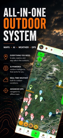


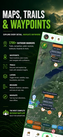
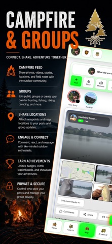
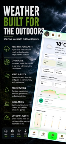
About
Explore smarter. Adventure farther. Dryads is your all-in-one outdoor companion — blending AI-powered mapping, real-time weather, offline navigation, and a social hub for explorers, hikers, hunters, anglers, and researchers. Interactive AI Maps Satellite, topographic, and street layers Create and customize waypoints with icons and colors Public markers for wildlife, hazards, and trail features Fog of War mode for exploration challenges Weather & Conditions 7-day forecasts Moon phases, sunrise/sunset Local weather AI Wilderness Tools AI trip planning and risk checks on posts Gear coach suggestions tailored to your activity Photo recognition for wildlife and plants Field calculator with ballistic & speed tools Field Kit Dashboard Trip planner & trip journal Gear checklists Notes and calculators Works offline Community & Social Share posts, photos, and videos on the campfire wall Reactions, saves, and custom icons Groups and friend networks Sponsor and affiliate features (border highlights, giveaways, events) Memberships Free users get full access to maps, markers, and social Basecamp: unlocks more AI and tools Pathfinder: advanced AI, offline, and pro features Sponsors & Affiliates: brand visibility, giveaways, media feeds Why Dryads? Unlike typical maps, Dryads fuses AI, mapping, and social collaboration into a single platform. Plan smarter trips, connect with outdoor communities, and explore confidently. Terms of Use: https://www.dryads.app/termsofuse Privacy Policy: https://www.dryads.app/privacypolicy
What's new · 1.1.18
What’s New in Dryads This update brings major improvements to maps, weather, terrain, and mountain exploration: - Calendar Fixes – Resolved an issue affecting the Calendar for a smoother, more reliable experience. - New Weather Layers – Added additional weather overlays, including snow coverage and a lightning heatmap. - Improved Ski Trails – Ski Trails can now display ski areas near your location, making it easier to discover nearby mountains and resorts. - Mountain Peaks & Elevation – Added clearer mountain names, peak locations, and elevation information, with larger map labels for better visibility. - Customizable Elevation Contours – You can now control your elevation contour settings, including contour intervals, transparency, labels, and line appearance. - New Elevation Colors – Elevation contours can now be color-coded by height, making changes in terrain and higher elevations much easier to identify directly on the map. - Map & Performance Improvements – Additional refinements and fixes throughout Dryads for a better overall experience.
Details