

Field Area Measure on GPS Map
Dhara Hingu · Utilities
Independent analytics for this App Store listing. AppTracker is not affiliated with Dhara Hingu.
Chart standing · US
What changed · US
Listing changes AppTracker has observed for this app in this storefront — new versions, price moves, rating shifts, and store copy.
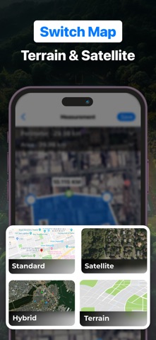
We’ve made Field Area Measure GPS Map even better for you! - Improved Accuracy : Enhanced GPS tracking for more precise area, distance, and perimeter measurements. - New Map Layers : Added support for Terrain, Hybrid, and Satellite views for better visualization. - Photo Attachments : You can now add photos to your saved measurements for better documentation. - Custom Groups : Organize your projects with names, notes, colors, and descriptions for easier tracking. - Offline Mode Upgrade : Work smoothly even without internet access. - Export & Share Options : Save and share measurements in KML, KMZ, PDF, and GeoJSON formats. - User Experience Enhancements : Cleaner design, faster performance, and bug fixes for a smoother workflow. Update now and turn your iPhone into a smart, portable land measurement system!er performance.
Price & rating history · US
Reconstructed from the listing changes AppTracker has observed in this storefront. A field is charted once it has changed more than once, and each line starts at the value it moved from.
Average rating · ★ 4.38 now · 19 changes on record
Ratings breakdown · US
The star breakdown behind this app's rating in this storefront.
In-app purchases · US
What this app sells inside itself, grouped by kind and priced for this storefront.
Screenshots




About
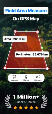
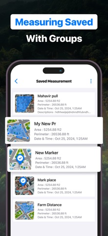
Field Area Measure GPS Map is your all-in-one tool for measuring land, fields, and property with precision. Whether you're working in agriculture, construction, land surveying, or real estate, this app makes it easy to calculate area, distance, and perimeter using GPS or manual input. The app allows you to measure land by placing markers on the map or by physically walking the boundary with your phone in GPS mode. You can measure with confidence in various units such as square meters, square feet, hectares, acres, and more. This flexibility makes it ideal for professionals in different fields and across different regions. You can save your measurements for future reference and organize them into custom groups. Add names, notes, and descriptions to each measurement for easier tracking and understanding. Custom group colors let you visually differentiate your projects, which is especially helpful when managing multiple areas or plots. Field Area Measure GPS Map works seamlessly both online and offline, so you can rely on it in the field—even in areas with limited internet access. You can export your saved measurements in widely used formats like KML, KMZ, PDF, and GeoJSON, and also import existing data for further planning. Sharing your work with team members or clients is just as simple, using email or messaging apps. To give you more control and better visibility, the app supports multiple map layers including Satellite, Terrain, Hybrid, and Standard views. You can zoom into details using the fullscreen mode, drop pins to highlight important locations, and center the map based on your current GPS location. You can also find specific places or coordinates using manual input or geohash search. Additional features include adding photos to your measurements, inputting coordinates manually, and supporting large data projects. The app is also equipped with a geographic camera mode to help document and visualize land data more effectively. Designed for farmers, surveyors, architects, planners, and anyone who needs reliable land measurement, Field Area Measure GPS Map makes complex tasks simple and fast. With an optional subscription, you can remove ads and unlock advanced features for a more efficient and focused experience. Premium Subscriptions & Terms : USD $ 4.99 Weekly Subscription USD $ 9.99 Monthly Subscription USD $ 29.99 Yearly Subscription The subscription will automatically renew unless turned off in your iTunes Account Settings at least 24 hours before the current period ends. You can go to your iTunes Account settings to manage your subscription and turn off auto-renew. Your iTunes Account will be charged when the purchase is confirmed. Privacy Policy : https://sites.google.com/view/area-privacy-policy/home Terms of Use : https://sites.google.com/view/area-tou/home Feedback:- If you have any concerns or recommendations, please mail us at apptrendz44@gmail.com Always Happy To Help :) Download the app today and turn your iPhone into a smart, portable land measurement system. Thank you so much!
What's new · 2.1
We’ve made Field Area Measure GPS Map even better for you! - Improved Accuracy : Enhanced GPS tracking for more precise area, distance, and perimeter measurements. - New Map Layers : Added support for Terrain, Hybrid, and Satellite views for better visualization. - Photo Attachments : You can now add photos to your saved measurements for better documentation. - Custom Groups : Organize your projects with names, notes, colors, and descriptions for easier tracking. - Offline Mode Upgrade : Work smoothly even without internet access. - Export & Share Options : Save and share measurements in KML, KMZ, PDF, and GeoJSON formats. - User Experience Enhancements : Cleaner design, faster performance, and bug fixes for a smoother workflow. Update now and turn your iPhone into a smart, portable land measurement system!er performance.
Details