

Vence
Merck Sharp & Dohme LLC · Business
Independent analytics for this App Store listing. AppTracker is not affiliated with Merck Sharp & Dohme LLC.
Chart standing · US
What changed · US
Listing changes AppTracker has observed for this app in this storefront — new versions, price moves, rating shifts, and store copy.
Share your map on gathering day Gathering is a team effort, and now your map is too. Share your live ranch map with hired hands right when the work starts, no account setup and no logins to hand out. When riders opt in, you can see where everyone is on the map, so you can coordinate the gather in real time and know who is covering which ground. We also squashed some bugs and made performance improvements under the hood for a smoother, faster experience.
In-app purchases · US
No in-app purchases.
Screenshots


About
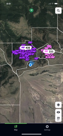
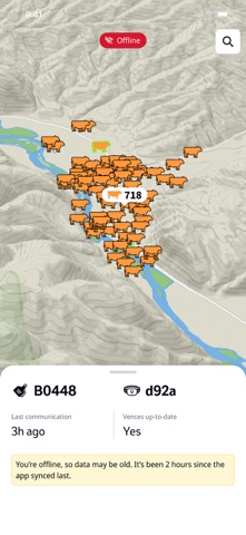
Grazing without limits. Ranching without boundaries. Unlock the full potential of every acre with Vence virtual fencing — the smarter way to manage your cattle herd. Vence is a virtual fencing livestock management system for cattle. Vence ranchers are able to use the app to manage their herd from anywhere, create virtual fences to dictate grazing behavior, and monitor animal location and movement in real-time. Each cow wears a Vence collar, which contains a global positioning system (GPS) transceiver that tracks its position and a radio frequency (RF) transceiver that communicates with solar powered Vence base stations. Using our Vence software suite, you can define the boundaries of the virtual fence line. The lines can be endlessly redrawn to include or exclude specific areas, accommodate rotational grazing and protect environmentally sensitive land. Cut costs. Conserve resources. Control grazing across even the toughest terrain with virtual fencing that combines real-time herd data with powerful, hands-off precision. Profit, sustainability, and efficiency — all in one system. Vence puts smarter grazing at your fingertips, saving you time, effort, and money compared to traditional fencing. Ready to transform your ranch? Learn more at VenceFence.com.
What's new · 1.6.0
Share your map on gathering day Gathering is a team effort, and now your map is too. Share your live ranch map with hired hands right when the work starts, no account setup and no logins to hand out. When riders opt in, you can see where everyone is on the map, so you can coordinate the gather in real time and know who is covering which ground. We also squashed some bugs and made performance improvements under the hood for a smoother, faster experience.
Details