

Radius On Map: Draw Circles
takeshi ogawa · Productivity
Independent analytics for this App Store listing. AppTracker is not affiliated with takeshi ogawa.
Chart standing · US
What changed · US
Listing changes AppTracker has observed for this app in this storefront — new versions, price moves, rating shifts, and store copy.
Fixed an issue so that your km/mi setting is now kept.
Price & rating history · US
Reconstructed from the listing changes AppTracker has observed in this storefront. A field is charted once it has changed more than once, and each line starts at the value it moved from.
Average rating · ★ 4.50 now · 16 changes on record
Screenshots

About
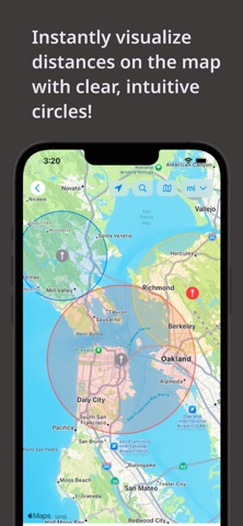
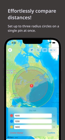
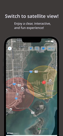
Quickly visualize a clear radius around any pin you place on the map! Features: - You can set up to three radius circles for a single pin, making it easy to compare multiple distances at the same time. - Includes location search and exploration tools, so you can instantly check what’s within a certain distance from you or any other location. - Offers both standard map views and satellite imagery for a more interactive and visually appealing experience. - Pins are saved automatically, allowing you to revisit them whenever you need. Use Cases: - When house hunting, check the distance from potential homes to schools, grocery stores, train stations, and more by placing pins and seeing the radius. - For dating apps, visualize where someone might be based on the distance shown. - Great for gamers (e.g., Airline Manager) to get a quick visual estimate of flight ranges from a hub airport. - Check compliance zones: Visualize important boundaries like delivery areas or the 150 air-mile radius for driver logs. - Plan trips by identifying tourist attractions or landmarks within a specific radius around your destination. - Use it for education, like geography or social studies projects, to explore what’s within a given range of a location. - Plan walking or jogging routes by setting a radius from your starting point. - Choose event locations easily by pinpointing areas that are central and convenient for all attendees. - During emergencies, map out evacuation zones to understand which residents fall within the range of nearby shelters. This app is perfect for simplifying exploration, planning, and decision-making!
What's new · 1.0.9
Fixed an issue so that your km/mi setting is now kept.
Details