

3D Mappa - GIS & Topo Models
Andres Narvaez · Navigation
Independent analytics for this App Store listing. AppTracker is not affiliated with Andres Narvaez.
Chart standing · US
What changed · US
Listing changes AppTracker has observed for this app in this storefront — new versions, price moves, rating shifts, and store copy.
• Earthwork Cut & Fill Calculations: Perform instant earthwork estimates directly in the field. Calculate cut, fill, and net volumes using an adjustable base plane or two-surface comparison. • Terrain Suitability Tool: Screen sites in seconds by defining maximum slope angle, elevation range, solar aspect, and minimum contiguous buildable footprint. • 3D Route & Terrain Profiling: Measure real-world terrain-following paths, elevation gain/loss, slope gradient, and calculate closed-polygon plan and surface areas. • GeoTIFF & DEM Raster Exports: Export georeferenced elevation DEMs and RGB GeoTIFFs (EPSG:3857) directly into QGIS, ArcGIS, and CAD workflows. • Client Site Briefs: Generate structured, client-ready PDF reports complete with site maps, elevation profiles, and AI audit summaries.
Price & rating history · US
Reconstructed from the listing changes AppTracker has observed in this storefront. A field is charted once it has changed more than once, and each line starts at the value it moved from.
Average rating · ★ 4.56 now · 2 changes on record
Ratings breakdown · US
The star breakdown behind this app's rating in this storefront.
Screenshots


About
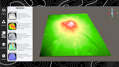
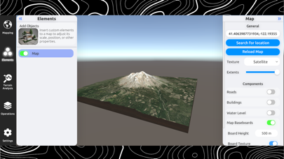
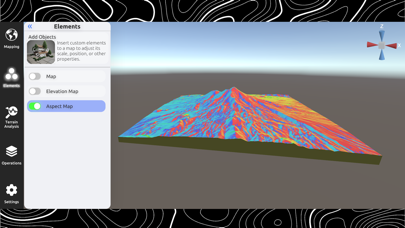
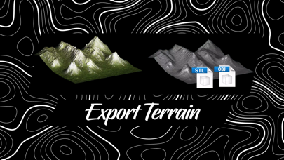
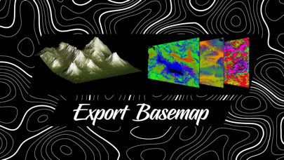
3D Mappa revolutionizes the world of GIS for mobile. Designed for professionals and enthusiasts alike, our app puts a powerful suite of terrain analysis tools in the palm of your hand, making complex geospatial tasks effortless and instantaneous. Export data in seconds to industry-standard formats like GeoTIFF, DXF, SHP, GeoJSON, KML, OBJ, glTF, and STL, ensuring seamless compatibility with AutoCAD, QGIS, and ArcGIS. From surveyors and civil engineers to land managers and outdoor enthusiasts, 3D Mappa allows you to visualize and evaluate land features with unparalleled precision. Instantly generate elevation models, analyze slopes, run cut & fill earthwork calculations, and automate site audits using integrated AI. Say goodbye to cumbersome desktop software and hello to streamlined, mobile-first GIS. INTELLIGENT TERRAIN ANALYSIS Visualize and compute terrain metrics through dynamic analytical lenses: • Cut & Fill Earthwork: Calculate precise cut, fill, and net earthwork volumes using reference planes or two-surface comparison. • Terrain Suitability Screening: Filter sites by maximum slope, elevation thresholds, downslope aspect, and contiguous area. • Route & Path Profiling: Measure true terrain-following 3D distance, elevation changes, slope gradients, and closed-polygon plan/surface areas. • Contour Maps: View precise elevation intervals with connecting index lines. • Elevation Heatmaps: Depict height variations through rich, high-contrast color gradients. • Slope & Aspect: Instantly calculate the steepness and compass facing direction of any surface. • Normal & Landform Maps: Analyze surface orientation and detailed geomorphological features. • Flow & Curvature: Visualize drainage patterns and terrain curvature for hydrological assessment. • Cross-Sectioning: Generate interactive 2D elevation profiles along custom waypoint paths. PRO-GRADE MODELING & IMPORT • Data Server Integration: Create high-resolution Digital Elevation Models (DEMs) directly from satellite and terrain servers. • Custom Point Cloud & LiDAR Imports (XYZ, CSV, LAS/LAZ): Bring your own survey data to life with accelerated Delaunay triangulation into interactive 3D meshes. • Live AI Site Audits: Grounded AI insights for land ownership, flood risks, soil characteristics, and zoning constraints. • Client Site Briefs: Compile survey findings, cross-section profiles, and AI insights into clean, shareable PDF documentation. INDUSTRY-STANDARD EXPORTS Move your data from the field to CAD and GIS software in seconds: • GIS Formats: GeoTIFF (Elevation DEM & Georeferenced RGB), SHP, GeoJSON, KML • CAD & 3D Modeling: DXF, STL, glTF, OBJ • High-Resolution Output: Raw coordinate CSVs and high-fidelity textures up to 8K resolution. BUILT FOR SPEED & EFFICIENCY • Real-Time Geospatial Engine: Instant calculations for area, surface area, elevation, and volume. • Location History & Bookmarks: Access past sites and coordinates with a single tap. • Cloud Persistence (Infinite Tier): Securely sync project history and custom data across devices. Experience the future of mobile GIS. Terms of Use: https://www.apple.com/legal/internet-services/itunes/dev/stdeula/
What's new · 3.0
• Earthwork Cut & Fill Calculations: Perform instant earthwork estimates directly in the field. Calculate cut, fill, and net volumes using an adjustable base plane or two-surface comparison. • Terrain Suitability Tool: Screen sites in seconds by defining maximum slope angle, elevation range, solar aspect, and minimum contiguous buildable footprint. • 3D Route & Terrain Profiling: Measure real-world terrain-following paths, elevation gain/loss, slope gradient, and calculate closed-polygon plan and surface areas. • GeoTIFF & DEM Raster Exports: Export georeferenced elevation DEMs and RGB GeoTIFFs (EPSG:3857) directly into QGIS, ArcGIS, and CAD workflows. • Client Site Briefs: Generate structured, client-ready PDF reports complete with site maps, elevation profiles, and AI audit summaries.
Details