

WeGlide Copilot
WeGlide UG (haftungsbeschraenkt) · Navigation
Independent analytics for this App Store listing. AppTracker is not affiliated with WeGlide UG (haftungsbeschraenkt).
Chart standing · US
What changed · US
Listing changes AppTracker has observed for this app in this storefront — new versions, price moves, rating shifts, and store copy.
show the recording as a Live Activity sign live tiles with the queried token
Ratings breakdown · US
The star breakdown behind this app's rating in this storefront.
In-app purchases · US
What this app sells inside itself, grouped by kind and priced for this storefront.
Screenshots
Keywords this app targets
Search terms AppTracker associates with this app — estimates, not search volume. ❝ = in the app's title; a highlighted number is its current position for that term.
Similar apps
Competitors and close alternatives, as estimated by AppTracker.
 iGlide Lite
Logic Design
iGlide Lite
Logic Design
 iGlide Advanced
Logic Design
iGlide Advanced
Logic Design
 SeeYou Navigator
NAVITER - Informacijske tehnologije in druge storitve, d.o.o
SeeYou Navigator
NAVITER - Informacijske tehnologije in druge storitve, d.o.o
 SkyLogger
Hartwig Wiesmann
SkyLogger
Hartwig Wiesmann
 Flyskyhy
Renevision
Flyskyhy
Renevision
 Gaggle Paragliding, Ultralight
Viszen Pty Ltd
Gaggle Paragliding, Ultralight
Viszen Pty Ltd
 eVario2 - Variometer Pro
Jean-Marc Meyer
1 shared topic
eVario2 - Variometer Pro
Jean-Marc Meyer
1 shared topic
 GAB Aviation Tools
GERT ANDREAS BARRING
GAB Aviation Tools
GERT ANDREAS BARRING
About
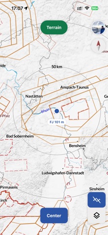
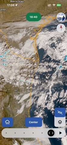
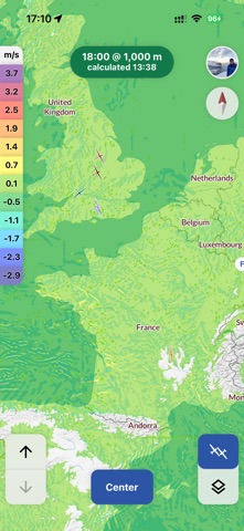
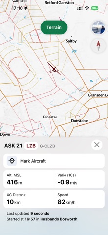
WeGlide Copilot: Real-time Data for Gliding Make better strategic decisions and boost your flight performance with WeGlide Copilot. Access real-time air mass data, thermal maps, and satellite imagery. Specifically engineered for the challenges of cockpit connectivity. Key Features: Record Flights: The first valid flight logger app for national competitions. Great as backup. Live Vertical Airspeed: Visualize air mass climb rates along your route. Identify the best lines based on the real-time movement of all gliders in the area from OGN. Live Thermal Height: Monitor current thermal ceilings and detect weather boundaries long before you reach them. Real-Time Thermals: See active updrafts the second a glider starts circling. Tap for detailed info on altitude, strength, and age of the lift. High-Frequency Satellite: Stay ahead of the weather with images updating every 10 minutes, including rain radar and loop functions. SkySight Integration: Seamlessly view XC-Speed and wave forecasts directly on your moving map. Built for the Cockpit: Optimized to ensure data updates even with spotty LTE reception. Features a robust offline mode with worldwide terrain maps.
What's new · 3.0.0
show the recording as a Live Activity sign live tiles with the queried token
Details