

GaugeStage: Water Levels
Timothy Johnson · Navigation
Independent analytics for this App Store listing. AppTracker is not affiliated with Timothy Johnson.
Chart standing · US
What changed · US
Listing changes AppTracker has observed for this app in this storefront — new versions, price moves, rating shifts, and store copy.
This version includes bugfixes to ensure you have the latest data available.
Price & rating history · US
Reconstructed from the listing changes AppTracker has observed in this storefront. A field is charted once it has changed more than once, and each line starts at the value it moved from.
Average rating · ★ 4.50 now · 5 changes on record
Ratings breakdown · US
The star breakdown behind this app's rating in this storefront.
In-app purchases · US
What this app sells inside itself, grouped by kind and priced for this storefront.
Screenshots




About
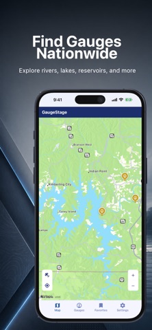
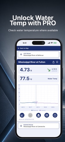
GaugeStage - Know the Water Before You Go Know the water before you go. Track real-time water levels across 12,000+ rivers, streams, and creeks nationwide so you can boat, fish, and plan with confidence. Find any gauge instantly with Map View, get flood alerts, and monitor changing conditions in seconds. Real-Time Water Conditions Across the United States GaugeStage provides fast, reliable access to real-time water levels, river stages, and flood conditions from over 12,000 NOAA-monitored gauges across the U.S. Whether you’re checking river levels before launching, tracking fishing conditions, or monitoring rising water near your home, GaugeStage helps you stay informed and prepared. Key Benefits - Track real-time water levels and river stages nationwide - Monitor fishing conditions, current changes, and water trends - Stay ahead of flood conditions with alerts and warnings - Quickly find any gauge with an interactive map - Make safer decisions for boating, fishing, and waterfront activity What You Get (Free) - Real-time river, stream, and creek gauge readings (12,000+ locations) - Interactive Map View to find gauges anywhere in the U.S. - Favorites list for quick access to frequently checked locations - Flood notifications to stay ahead of changing water conditions - Clean, fast interface designed for quick checks on the go Upgrade to GaugeStage Pro Unlock advanced tools for deeper insight and better planning: - Advanced charting with 30-day historical water level trends - 15-day river forecasts (where available) - Expanded NOAA hydrological data and charts - Detailed flood information and impact data - Gauge photos and additional location context - Full access to all available gauge data nationwide Built for Anyone Who Uses the Water GaugeStage is designed for: - Anglers tracking fishing conditions, water levels, and current changes - Boaters and captains planning safe navigation and river travel - Riverfront homeowners monitoring rising water and flood risk - Marina operators and professionals managing daily conditions - Anyone who lives, works, or plays near rivers, lakes, streams, or creeks Why GaugeStage - Nationwide coverage with 12,000+ gauges - Real-time NOAA data you can trust - Designed for speed, clarity, and real-world use - Eliminates the need to search multiple government websites - Helps you understand water conditions quickly and easily From major rivers to local creeks, GaugeStage gives you the insight you need to understand changing water conditions and make better decisions. Download GaugeStage today and stay ahead of the water. Privacy Policy - https://gaugestage.com/privacy Terms of Use - https://www.apple.com/legal/internet-services/itunes/dev/stdeula/
What's new · 1.6.2
This version includes bugfixes to ensure you have the latest data available.
Details