

Weather Radar Norway – Rain
CHANG GOO KIM · Weather
Independent analytics for this App Store listing. AppTracker is not affiliated with CHANG GOO KIM.
Chart standing · US
What changed · US
Listing changes AppTracker has observed for this app in this storefront — new versions, price moves, rating shifts, and store copy.
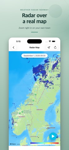
Radar Map - New Radar Map: the latest precipitation radar is drawn straight onto a map of Norway. Zoom and pan anywhere, and play the last few hours as an animation. - My Location: tap the location button to centre the map on where you are. If you are outside the radar coverage, the map zooms out instead, so you still see where the precipitation is - handy when you are travelling or close to the border. - Fewer ads: they now appear less often, and never on the first screen after you open the app for the day. - Steadier loading: when a radar loop cannot be loaded, the app shows the latest still image instead of an error. - Privacy manifest added, plus general stability fixes. Data from The Norwegian Meteorological Institute.
In-app purchases · US
No in-app purchases.
Screenshots


Keywords this app targets
Search terms AppTracker associates with this app — estimates, not search volume. ❝ = in the app's title; a highlighted number is its current position for that term.
Similar apps
Competitors and close alternatives, as estimated by AppTracker.
 Rain Radar Pro - Live Forecast
DeluxeWare
Rain Radar Pro - Live Forecast
DeluxeWare
 Radar Now: Rain and Snow Map
Mykhailo Davydovych
Radar Now: Rain and Snow Map
Mykhailo Davydovych
 Drops Radar – Rain Radar live
WDTEC GmbH
Drops Radar – Rain Radar live
WDTEC GmbH
 WeatherٞPro
Si Yong Limited
WeatherٞPro
Si Yong Limited
 Canada Weather
Tailwheel Labs Ltd.
Canada Weather
Tailwheel Labs Ltd.
 Zoom Earth - Weather Forecast
Neave Interactive
Zoom Earth - Weather Forecast
Neave Interactive
 MORECAST Weather App
UBIMET GmbH
MORECAST Weather App
UBIMET GmbH
 Pflotsh Storm
Garzotto GmbH
Pflotsh Storm
Garzotto GmbH
About
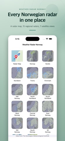
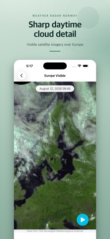
Weather Radar Norway shows you where the rain and snow is right now, using radar and satellite imagery from The Norwegian Meteorological Institute. RADAR MAP See the latest precipitation radar drawn directly on a map of Norway. Zoom and pan anywhere, tap the location button to centre the map on where you are, and press play to watch the last few hours of radar move across the country. RADAR FOR THE WHOLE COUNTRY - Norway and the Nordic region in a single image - Regional radar in detail: Finnmark, Troms, Nordland (north and south), NW, West, Central, East, SW, South and SE Norway - Gardermoen X-band radar for the Oslo area SATELLITE IMAGERY - Europe, the Mediterranean and Africa in infrared and visible light - Global infrared view MADE FOR A QUICK LOOK - Every radar and satellite series plays back as an animation, so you can see which way the weather is moving - Pinch to zoom into any image - Times are shown in Norwegian local time, wherever you are - Available in Norwegian and English All data comes from The Norwegian Meteorological Institute (MET Norway). This app is not affiliated with the institute. The app uses your location only to centre the radar map on you. It is not stored and not shared.
What's new · 2.3
Radar Map - New Radar Map: the latest precipitation radar is drawn straight onto a map of Norway. Zoom and pan anywhere, and play the last few hours as an animation. - My Location: tap the location button to centre the map on where you are. If you are outside the radar coverage, the map zooms out instead, so you still see where the precipitation is - handy when you are travelling or close to the border. - Fewer ads: they now appear less often, and never on the first screen after you open the app for the day. - Steadier loading: when a radar loop cannot be loaded, the app shows the latest still image instead of an error. - Privacy manifest added, plus general stability fixes. Data from The Norwegian Meteorological Institute.
Details