

GK Field Mapper
GK Technology, Inc. · Navigation
Independent analytics for this App Store listing. AppTracker is not affiliated with GK Technology, Inc.
Chart standing · US
What changed · US
Listing changes AppTracker has observed for this app in this storefront — new versions, price moves, rating shifts, and store copy.
Fixes issue selecting Coordinate System Fix issue retrojecting grd's in the map
Ratings breakdown · US
The star breakdown behind this app's rating in this storefront.
Screenshots



About
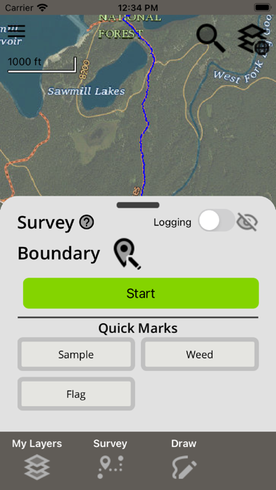
Handle all your mobile mapping needs with one powerful app. Upload geospatial data, track and record GPS locations, and visualize collected data in map view with ease. GK Field Mapper is designed to meet your mobile mapping needs, offering a comprehensive suite of features. Features: - Survey points, lines, polygons, continuous points, and benchmarks - Log full GPS data for entire fields - Create quickmarks while surveying other features simultaneously - Utilize internal or external GPS devices via Bluetooth or WiFi - Load your own geo-referenced images (.grd, .bmp, .jpg) - View vector data (.shp, .kml, .kmz, .(geo)json, .dxf, .dwg, .gpx, and .csv - Create your own drawings and measurements - Style labels and colors to represent and differentiate your data - Edit and view attribute fields for vector data - View elevation profiles for surveyed GPS logs and lines - Load web imagery from Google/ESRI/Open Street Map - Generate routes to known addresses or features - Offline functionality in remote areas - Automatically sync data online for easy transfer to other devices Subscriptions: - Users that purchase a subscription unlock additional mapping features and gain access to the GK Cloud to seamlessly transfer data between mobile devices, PCs, and/or GK Technology, Inc.’s ADMS (Ag Data Mapping Solution) software. - GK Cloud allows automatic synchronization between mapping files and folders on your field device and your cloud account. - Subscriptions automatically renew unless auto-renew is turned off at least 24 hours before the end of the current period. You will be charged for renewal within 24 hours of the end of the current period. - Privacy Policy: https://cloud.gktechinc.com/privacy - Terms of Service: https://cloud.gktechinc.com/termsofservice
What's new · 0.0.91
Fixes issue selecting Coordinate System Fix issue retrojecting grd's in the map
Details