

CycleMaps
motocode ltd · Navigation
Independent analytics for this App Store listing. AppTracker is not affiliated with motocode ltd.
Chart standing · US
What changed · US
Listing changes AppTracker has observed for this app in this storefront — new versions, price moves, rating shifts, and store copy.
Welcome to CycleMaps 51 — guiding cyclists since 2011. If you like the app, please take a moment to leave a review in the App Store — it makes an enormous difference. Thank you. What's New in 51.0 Ready for iPhone Duo - CycleMaps is optimized for iPhone Duo: plan on the outer display, open it up for the full map - Route details, elevation chart and ride controls make use of the wider screen - Works in Split View alongside your other apps A New OpenStreetMap Map - The OpenStreetMap map is now a crisp vector map, served by CycleMaps, worldwide - Place names in your language, wherever you ride - Cycle paths are drawn natively on every map type — Apple, Google and OpenStreetMap — with a palette for dark mode - Tap a cycle path to see what it is Offline Maps [Feature available only for paid users] - Rebuilt on the vector map: smaller downloads, sharper at every zoom - Download this area: pick any region on the map and take it offline - Favorite routes download their corridor automatically, and offline packs are available by cycling country - Downloaded areas bring their cycle paths along - A new Offline downloads screen to manage everything you've saved Riding - The elevation profile is now shown in the ride panel, colored by the ground ahead - Routes that arrive without elevation data get a profile anyway - The part of the route you've already ridden is dimmed on the map - Directional haptics: feel a left or a right turn coming - The speedometer can stay on outside rides, and it scales with your text size - Dynamic zoom can be switched off to keep a fixed navigation zoom - Import GPX and KML routes from the Files app: Menu → Import Accessibility - Every ride, planning and browsing screen now fits the larger accessibility text sizes Bug Fixes - Rides synced from Apple Watch always land on the right ride, with the right distance - The watch elevation highlight follows the ride's own position - The menu closes after picking a map type - Correct look-ahead zoom on the OpenStreetMap map - Stability and reliability improvements across the app Also in this release The New Siri (iOS 27) - Start cycling navigation to any destination, add stops, share your ETA or stop navigation — just ask Siri - "Avoiding busy roads" selects the Quiet route; "Cycle home" and "Start a free ride" work on iPhone and Apple Watch Route Planning - Redesigned route composer: every stop visible and editable, with From/To slots and one-tap reverse - Switch between Quiet, Balanced and Direct with a tap on the route panel - "Try to find newer": refresh the route saved with a favorite or past ride Pause & Resume - Pause your ride and pick it up again, with optional auto-pause during long stops; paused time is excluded from your ride Share Your ETA - Share your ETA while riding; Premium riders share a live link that friends can follow on a map, no app needed Widgets, Shortcuts & More - Home Screen widgets, Control Center controls, Siri shortcuts and "Your cycling week" recap notifications AI Ride Recap [Feature available only for paid users] - A natural-language summary of any past ride, generated on your device (requires Apple Intelligence)
Ratings breakdown · US
The star breakdown behind this app's rating in this storefront.
In-app purchases · US
What this app sells inside itself, grouped by kind and priced for this storefront.
Screenshots





Keywords this app targets
Search terms AppTracker associates with this app — estimates, not search volume. ❝ = in the app's title; a highlighted number is its current position for that term.
Similar apps
Competitors and close alternatives, as estimated by AppTracker.
 Bikemap: Bicycle Tracker & GPS
Bikemap GmbH
Bikemap: Bicycle Tracker & GPS
Bikemap GmbH
 Cyclers: Bike Route Planner
Umotional s.r.o.
2 shared topics
Cyclers: Bike Route Planner
Umotional s.r.o.
2 shared topics
 Ride with GPS: Bike Navigation
Ride with GPS
Ride with GPS: Bike Navigation
Ride with GPS
 cycle.travel - map and planner
Editions Systeme D Ltd
cycle.travel - map and planner
Editions Systeme D Ltd
 Naviki
beemo GmbH
1 shared topic
Naviki
beemo GmbH
1 shared topic
 WristTopo: Maps for Watch
Piotr Janik
WristTopo: Maps for Watch
Piotr Janik
 Bike Citizens Cycling App GPS
Smettly GmbH
Bike Citizens Cycling App GPS
Smettly GmbH
 Trckify
beeVisible GmbH
Trckify
beeVisible GmbH
About
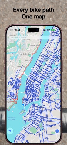
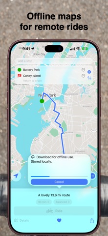
BICYCLE ROUTES CycleMaps plans routes using data from multiple sources and prioritises cycle paths and quiet streets — everywhere. See your route’s elevation profile before you ride. TURN‑BY‑TURN INSTRUCTIONS Clear, glanceable guidance shows your next turn, street name, and distance — without getting in the way of the map. ASK SIRI Start navigation, add stops along the way, or share your ETA — hands-free with the new Siri in iOS 27. GARMIN VARIA Pair your Garmin Varia rear radar to see vehicles approaching from behind — direction and proximity shown both on the map as a lane overlay and in the cycling computer. Live alerts on iPhone and Apple Watch. FREECYCLE Track an unplanned ride and save it as a workout in Apple Health. OFFLINE MAPS Download any area to ride without data. Favorite routes download their corridor automatically, and offline packs are available by cycling country. APPLE WATCH Cutting‑edge routing and navigation on your wrist. Cycling computer with speed, distance, time, heart rate and a live elevation chart. Garmin Varia alerts. Use haptics for guidance and save rides as workouts. Works independently of iPhone. HANDOFF Start navigating on iPhone and pick up on Apple Watch — or the other way around. Hand off your map position or continue reviewing past rides on any nearby Apple device. LIVE ACTIVITY See your speed, distance and next turn right on the Lock Screen and Dynamic Island — no need to unlock your phone mid-ride. COMPLEX ROUTES Plan routes with any number of stops — reorder them, optimise the order, or return to your starting point. GPX & KML SUPPORT Import routes from your club or any source — turn cues included, on iPhone and Apple Watch. Export your rides as GPX. CYCLE PATHS ON EVERY MAP Choose Apple Maps, Google Maps, or CycleMaps' own OpenStreetMap map — a crisp vector map, worldwide, with place names in your language. Cycle paths are drawn on all three; tap one to see what it is. FAVOURITE ROUTES Save your favourite routes. Create an account and sync across all your devices. CYCLE COMPUTER Mount your iPhone — or glance at your Apple Watch — for speed, distance cycled, distance remaining, elapsed time, heart rate, gradient, total ascent and ETA. A live elevation chart highlights your position along the route and alerts you when a climb is coming. Pause and resume your ride at any time — or let auto‑pause handle it when you stop. NEVER LOSE A RIDE Your ride is continuously checkpointed. If your phone or watch dies mid‑ride, CycleMaps recovers the ride and your workout is saved. SHARE YOUR ETA Share your ETA while riding. Premium riders share a live link: friends and family follow your ride on a map in their browser, no app needed. WIDGETS & SHORTCUTS Home Screen widgets for your favorites, cycling streak and weekly pace. Cycle home or start a FreeCycle from Control Center, the Lock Screen or Siri. AI RIDE RECAP A short, natural-language summary of any past ride — generated on your device, private and offline (requires Apple Intelligence). Found a problem or have a suggestion? Contact us at feedback@cyclema.ps CycleMaps is free to download. You can purchase CycleMaps Premium, a low‑cost yearly subscription that enables Apple Watch features, adds voice navigation and more. The subscription renews annually at the same price unless cancelled. Payment will be charged to your Apple Account, and renewal will be charged within 24 hours before the end of the current period. Auto‑renewal can be turned off in your account settings after purchase. Privacy policy: https://cyclema.ps/privacy Terms and conditions: https://cyclema.ps/terms
What's new · 51.1
Welcome to CycleMaps 51 — guiding cyclists since 2011. If you like the app, please take a moment to leave a review in the App Store — it makes an enormous difference. Thank you. What's New in 51.0 Ready for iPhone Duo - CycleMaps is optimized for iPhone Duo: plan on the outer display, open it up for the full map - Route details, elevation chart and ride controls make use of the wider screen - Works in Split View alongside your other apps A New OpenStreetMap Map - The OpenStreetMap map is now a crisp vector map, served by CycleMaps, worldwide - Place names in your language, wherever you ride - Cycle paths are drawn natively on every map type — Apple, Google and OpenStreetMap — with a palette for dark mode - Tap a cycle path to see what it is Offline Maps [Feature available only for paid users] - Rebuilt on the vector map: smaller downloads, sharper at every zoom - Download this area: pick any region on the map and take it offline - Favorite routes download their corridor automatically, and offline packs are available by cycling country - Downloaded areas bring their cycle paths along - A new Offline downloads screen to manage everything you've saved Riding - The elevation profile is now shown in the ride panel, colored by the ground ahead - Routes that arrive without elevation data get a profile anyway - The part of the route you've already ridden is dimmed on the map - Directional haptics: feel a left or a right turn coming - The speedometer can stay on outside rides, and it scales with your text size - Dynamic zoom can be switched off to keep a fixed navigation zoom - Import GPX and KML routes from the Files app: Menu → Import Accessibility - Every ride, planning and browsing screen now fits the larger accessibility text sizes Bug Fixes - Rides synced from Apple Watch always land on the right ride, with the right distance - The watch elevation highlight follows the ride's own position - The menu closes after picking a map type - Correct look-ahead zoom on the OpenStreetMap map - Stability and reliability improvements across the app Also in this release The New Siri (iOS 27) - Start cycling navigation to any destination, add stops, share your ETA or stop navigation — just ask Siri - "Avoiding busy roads" selects the Quiet route; "Cycle home" and "Start a free ride" work on iPhone and Apple Watch Route Planning - Redesigned route composer: every stop visible and editable, with From/To slots and one-tap reverse - Switch between Quiet, Balanced and Direct with a tap on the route panel - "Try to find newer": refresh the route saved with a favorite or past ride Pause & Resume - Pause your ride and pick it up again, with optional auto-pause during long stops; paused time is excluded from your ride Share Your ETA - Share your ETA while riding; Premium riders share a live link that friends can follow on a map, no app needed Widgets, Shortcuts & More - Home Screen widgets, Control Center controls, Siri shortcuts and "Your cycling week" recap notifications AI Ride Recap [Feature available only for paid users] - A natural-language summary of any past ride, generated on your device (requires Apple Intelligence)
Details