

IGNIS | Wildfire Operations
Ignis Technologies, Inc · Navigation
Independent analytics for this App Store listing. AppTracker is not affiliated with Ignis Technologies, Inc.
Chart standing · US
What changed · US
Listing changes AppTracker has observed for this app in this storefront — new versions, price moves, rating shifts, and store copy.
• Division and branch break icons can now be rotated. The icon turns with the map and holds its angle on satellite imagery, and its label stays upright. • Point labels no longer overlap full-size NWCG symbols. • Track recording keeps its progress if you close the recording sheet, and an in-progress track is kept if the app is closed. • PDF maps now draw above public data layers, and tapping a PDF map selects it instead of the layer underneath. • Location sharing now works the first time you share while offline. • Livestream alerts only appear once video is actually streaming. • Website attachments in Layer Details now open in Safari, and the Layer Details layout has been refreshed. • The highlight on a selected map feature now clears when you close its details. • If you cancel the Create Polygon prompt while drawing, your closing segment is now kept and the shape saves as a line. • Map layer order: Jurisdiction now sits above Public Land Ownership, and GACC sits below Severe Fire Danger Index. • Improved sync when a different user signs in on the same device. • Bug fixes and performance improvements.
Price & rating history · US
Reconstructed from the listing changes AppTracker has observed in this storefront. A field is charted once it has changed more than once, and each line starts at the value it moved from.
Average rating · ★ 4.80 now · 2 changes on record
Ratings breakdown · US
The star breakdown behind this app's rating in this storefront.
In-app purchases · US
No in-app purchases.
Screenshots


About
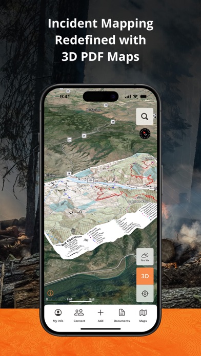
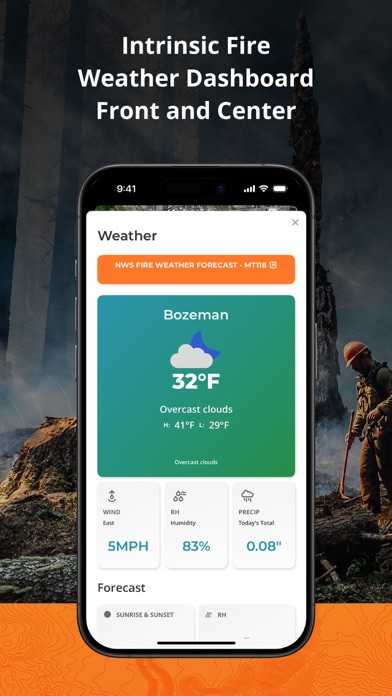
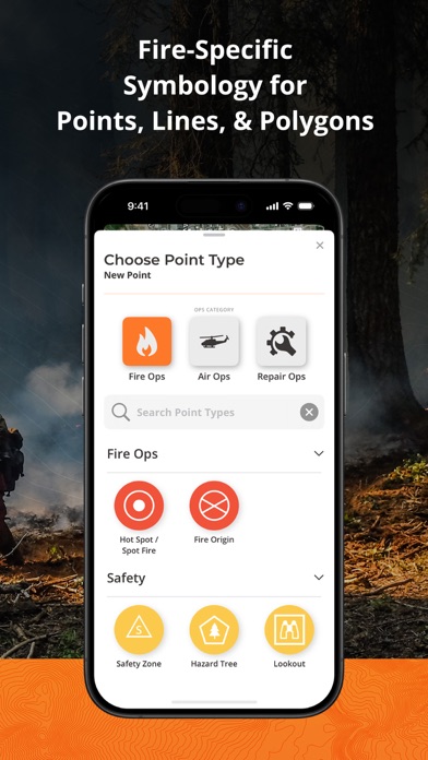
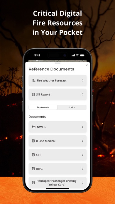
**Fireline Mapping Transformed with IGNIS** IGNIS redefines situational awareness, by centralizing essential fireline intelligence, offering unmatched capabilities: overlay GeoPDF maps on dynamic base maps, access curated wildland fire layers, utilize the Fire Weather Dashboard for detailed forecasts, and tap into fire-specific symbology and reference documents. Say goodbye to endless tabs and apps—IGNIS streamlines workflows, saving time and effort in the field. Step into the future of firefighting safety today. **IGNIS Core: FREE for Firefighters—Because the Right Tools Make a Difference** Access powerful fire intelligence tools right at your fingertips, so you can focus on what matters most: the task at hand. Key Features: - Store unlimited GeoPDF maps and layer them on dynamic base maps with 3D views. - Download sections of the base map for offline access. - Access fire-specific weather, including zone forecasts and location-based weather reports. - Build custom incident maps with fire-specific symbology. - Record tracks, draw lines, drop points, and calculate areas in acres. - Access essential reference documents directly in the app. - Curated map layers designed for wildland fire, including: - Severe Fire Danger Index - Fire Weather Advisories - Ground Medevac Transport Times - Current Incidents - Current & Historical Fire Perimeters - NOAA Weather Radar - ALERTCalifornia Cameras - Satellite Heat Detection - Wind Speed & Direction - And more! IGNIS CONNECT: OFFLINE TEAM COLLABORATION Take fireline coordination to the next level with IGNIS Connect. Everything in IGNIS Core, plus: - Team coordination through offline Bluetooth mesh networking. Share points, lines, and polygons—even without cell service. - A web app for centralized organization management, document and map sharing, and interactive mapping. - Unified coordination for field crews and office teams, keeping everyone aligned. Visit http://www.ignistech.io to learn more! Terms of Use: https://www.ignistech.io/terms-of-use Privacy Policy: https://www.ignistech.io/privacy-policy Get Help or Leave Feedback: https://help.ignistech.io/ Or email contact@ignistech.io
What's new · 2026.31
• Division and branch break icons can now be rotated. The icon turns with the map and holds its angle on satellite imagery, and its label stays upright. • Point labels no longer overlap full-size NWCG symbols. • Track recording keeps its progress if you close the recording sheet, and an in-progress track is kept if the app is closed. • PDF maps now draw above public data layers, and tapping a PDF map selects it instead of the layer underneath. • Location sharing now works the first time you share while offline. • Livestream alerts only appear once video is actually streaming. • Website attachments in Layer Details now open in Safari, and the Layer Details layout has been refreshed. • The highlight on a selected map feature now clears when you close its details. • If you cancel the Create Polygon prompt while drawing, your closing segment is now kept and the shape saves as a line. • Map layer order: Jurisdiction now sits above Public Land Ownership, and GACC sits below Severe Fire Danger Index. • Improved sync when a different user signs in on the same device. • Bug fixes and performance improvements.
Details