
Chart standing · US
Screenshots



About
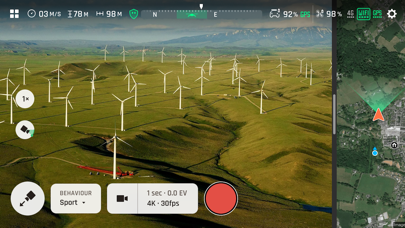
FreeFlight 7 is the Parrot piloting App specifically designed for the ANAFI Ai. The App makes complex drone missions simpler and quicker. Inspection, construction, infrastructure, energy, utilities, public safety, surveying, agriculture and defense professionals will benefit from advanced features: - Inspecting buildings with strong 4G connectivity in built-up urban missions. - Generating 3D models of buildings just by clicking on its land register - Creating standard mapping missions: Grid, Double Grid and Orbit. - Manually mapping infrastructures in 48 MP at 1fps with the GPS Lapse - Creating precise flight plans in complex environments thanks to a unique obstacle avoidance system. - Flying the drone automatically above a vehicle as a watchtower. - Using private mode to keep sensitive data safe. FreeFlight 7 is natively connected to PIX4Dcloud. Courtesy of Parrot and PIX4D, new users can enjoy 3 photogrammetry models to familiarize themselves with 3D mapping. For more information on ANAFI Ai, visit: https://www.parrot.com/en/drones/anafi-ai
What's new · 7.7.1
Versions: - FreeFlight 7.7.1 - Drone firmware & mission 7.7.1 - Controller 7.7.2 Main evolutions: - Regulatory “Emergency Mode” via SkyController4, requirement for Specific category flights in French national standard scenarios S1 & S3. - Drone path during FlightPlan/Photogrammetry missions is now displayed when device is not connected to internet. - Various bug fixes
Details