

Baloc: Your altitude profile
Felix Kampmann · Travel
Independent analytics for this App Store listing. AppTracker is not affiliated with Felix Kampmann.
Chart standing · US
What changed · US
Listing changes AppTracker has observed for this app in this storefront — new versions, price moves, rating shifts, and store copy.
Version 2.2.1 brings even greater precision, stability, and reliability to your adventures with BALOC! Here is what’s new: - Precise Map Recentering: Re-centering the map onto your current location now stays perfectly accurate without drift or offset, even when rotated or zoomed. - Reliable Tour Finalization: Stopping a recording – even while paused – now concludes your tour cleanly and preserves all pause intervals without missing a beat. - Smoother Offline Map Selection: Selecting offline map areas is now smoother than ever with modernized navigation, alongside connection optimizations for more reliable downloads of large map packages. - Polish & Stability: Additional under-the-hood fixes and optimizations ensure rock-solid tracking on every trail.
Ratings breakdown · US
The star breakdown behind this app's rating in this storefront.
In-app purchases · US
What this app sells inside itself, grouped by kind and priced for this storefront.
Screenshots



Keywords this app targets
Search terms AppTracker associates with this app — estimates, not search volume. ❝ = in the app's title; a highlighted number is its current position for that term.
Similar apps
Competitors and close alternatives, as estimated by AppTracker.
 Elevation Tracker: Altitude
Florian Delaunay
2 shared topics · 1 shared title word
Elevation Tracker: Altitude
Florian Delaunay
2 shared topics · 1 shared title word
 Hanglage - Skimo Computer
Bernhard Hering
1 shared topic
Hanglage - Skimo Computer
Bernhard Hering
1 shared topic
 YourTrail
Swann Faucon
2 shared topics
YourTrail
Swann Faucon
2 shared topics
 Altimeter Pro - GPS Altitude
Vladislav Zhirnov
1 shared title word
Altimeter Pro - GPS Altitude
Vladislav Zhirnov
1 shared title word
 Altimeter & Barometer Pro
Bog Bridges LLC
Altimeter & Barometer Pro
Bog Bridges LLC
 GPS Tracks
David Morneault
1 shared topic
GPS Tracks
David Morneault
1 shared topic
 Altimeter GPS & Barometer
Aesthetic Apps & Widgets srl
1 shared topic
Altimeter GPS & Barometer
Aesthetic Apps & Widgets srl
1 shared topic
 Bike Tracks
Core Coders Ltd
Bike Tracks
Core Coders Ltd
About
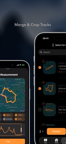
Track your adventures with barometric precision, follow GPX routes on offline vector maps, and master your elevation profiles. BALOC is the privacy-first outdoor app built for hiking, cycling, and mountaineering — 100% local, no account required, zero tracking. Whether you are conquering alpine peaks, riding MTB singletrack, backcountry skiing, or touring on motorbikes and water: BALOC fuses GPS and barometric pressure data on iPhone and Apple Watch to deliver noise-free altitude metrics and vertical ascent speed (VAM). KEY FEATURES: - ACCURATE ALTITUDE & ASCENT SPEED (VAM) No more erratic elevation jumps. Smart sensor filtering provides accurate elevation data and insights into your vertical ascent speed (VAM). - OFFLINE OSM VECTOR MAPS (Pro+) Download vector map regions globally. High-contrast SAC hiking scale (T1-T6), MTB ratings, and terrain shading keep you on track even without cell reception. - GPX ROUTE TRACING & WAYPOINTS (Pro+) Import GPX tracks and follow reference routes with clarity. Essential waypoints like huts, lakes, summits, or trails are displayed directly on the map. - PRECISION TRACK CROPPING Forgot to stop recording at the trailhead? Effortlessly crop the start or end of your recorded track directly in the app — the elevation profile updates instantly. - BEAUTIFUL ACTIVITY CARDS Generate high-resolution summary maps with your route, elevation profile, and key metrics for your community and social networks. - APPLE WATCH & HEALTHKIT Control tracking right from your wrist, monitor live heart rate, and sync workouts smoothly with Apple Health. - 100% PRIVATE & ON-DEVICE No signup, no ad tracking, no selling your data. Your routes remain securely on your device or in your personal iCloud. --- NOTE FOR LEGACY PRO USERS: Former one-time Pro purchases are honored for life with zero loss of functionality, including new features like track cropping! Terms of Use (EULA): https://www.apple.com/legal/internet-services/itunes/dev/stdeula/ Terms of Use (App): https://www.baloc-app.com/terms/ Privacy Policy: https://www.baloc-app.com/privacypolicy/
What's new · 2.2.1
Version 2.2.1 brings even greater precision, stability, and reliability to your adventures with BALOC! Here is what’s new: - Precise Map Recentering: Re-centering the map onto your current location now stays perfectly accurate without drift or offset, even when rotated or zoomed. - Reliable Tour Finalization: Stopping a recording – even while paused – now concludes your tour cleanly and preserves all pause intervals without missing a beat. - Smoother Offline Map Selection: Selecting offline map areas is now smoother than ever with modernized navigation, alongside connection optimizations for more reliable downloads of large map packages. - Polish & Stability: Additional under-the-hood fixes and optimizations ensure rock-solid tracking on every trail.
Details