

Anchor Sentry
Michael Dieter Konz · Navigation
Independent analytics for this App Store listing. AppTracker is not affiliated with Michael Dieter Konz.
Chart standing · US
What changed · US
Listing changes AppTracker has observed for this app in this storefront — new versions, price moves, rating shifts, and store copy.
• Fixed a possible freeze when starting the app. • Fixed a rare crash while the proximity alert is active. • New: at start, the app now lets you know when a newer version is available in the App Store. You can postpone the notice or skip that version, and it never appears while an anchor watch is running.
Ratings breakdown · US
The star breakdown behind this app's rating in this storefront.
In-app purchases · US
No in-app purchases.
Screenshots
Keywords this app targets
Search terms AppTracker associates with this app — estimates, not search volume. ❝ = in the app's title; a highlighted number is its current position for that term.
Similar apps
Competitors and close alternatives, as estimated by AppTracker.
 Anchor Plus
Roy Cadman
2 shared topics · 1 shared title word
Anchor Plus
Roy Cadman
2 shared topics · 1 shared title word
 Anchor Buddy
Universal Queue LLC
1 shared topic · 1 shared title word
Anchor Buddy
Universal Queue LLC
1 shared topic · 1 shared title word
 Anchor Alarm - Anchor Watch
Florian Kriesche
2 shared topics · 1 shared title word
Anchor Alarm - Anchor Watch
Florian Kriesche
2 shared topics · 1 shared title word
 Anchor Alarm / Watch
w&h GmbH
1 shared topic · 1 shared title word
Anchor Alarm / Watch
w&h GmbH
1 shared topic · 1 shared title word
 Anchor Alarm: ZENKOU PRO
UNITIO PLUS SL
1 shared title word
Anchor Alarm: ZENKOU PRO
UNITIO PLUS SL
1 shared title word
 Ankerwache Pro
Frank Urbanowitz
2 shared topics
Ankerwache Pro
Frank Urbanowitz
2 shared topics
 Virtual Anchor: Anchor Watch
Yoshiaki Hirokawa
Virtual Anchor: Anchor Watch
Yoshiaki Hirokawa
 Hooked: Remote Anchor Alarm
Kylee Davis
1 shared topic · 1 shared title word
Hooked: Remote Anchor Alarm
Kylee Davis
1 shared topic · 1 shared title word
About
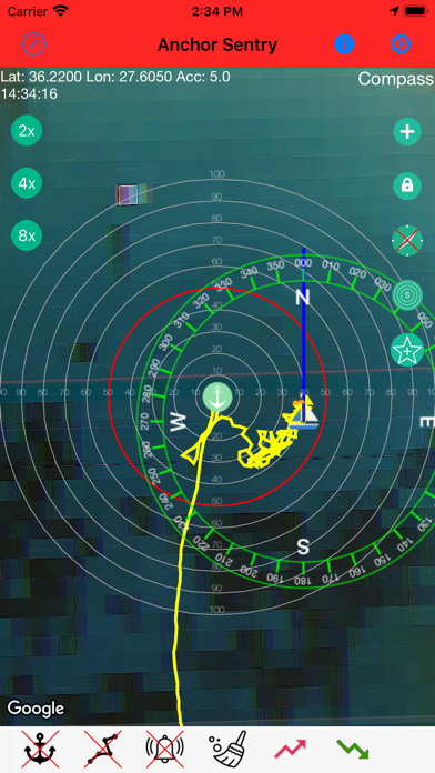
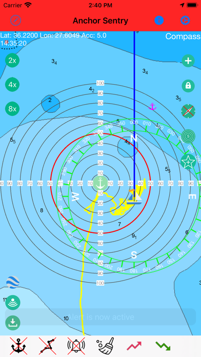
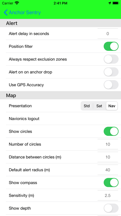
Anchor Sentry is an app to monitor the ship's position at anchor and inform the skipper when the anchor is dragging and thus the ship leaves the setup perimeter. Features: - Show current position on GoogleMaps map or Navionics map (To gain access to Navionics maps from this application, users with an active Navionics subscription in the Navionics Boating application must register with their Navionics credentials) - Distance circles to help finding a good anchor position - Drop anchor by tapping on map or by position or by bearing and distance - Can be used for anchoring with shore lines by watching the heading rather than the position - Tracks can be saves as GPX file for later processing - Option to set up prohibited zones which will trigger an alert when entered. These can be used indepent of the anchor state - Runs in the background even while other apps are used - Unique sync functionality which allows to pair two or more devices together to see the ships position even while out to shore for dinner - Barograph function included - Display real echo sounder data from a providing NMEA server - Optional compass overlay to help finding the bearing to the anchor - Option to show current position visible to friends and family on the Anchor Sentry website - Proximity alert between ships both using Anchor Sentry. To get warned when your neighbours anchor is dragging. - Automatic anchoring feature - Display maximum swinging circle - Save favorite anchoring places with pictures - Several setup options to customize your app
What's new · 2.12.2
• Fixed a possible freeze when starting the app. • Fixed a rare crash while the proximity alert is active. • New: at start, the app now lets you know when a newer version is available in the App Store. You can postpone the notice or skip that version, and it never appears while an anchor watch is running.
Details