

AR Island Map
NYANKO SOFTWARE · Navigation
Independent analytics for this App Store listing. AppTracker is not affiliated with NYANKO SOFTWARE.
Chart standing · US
What changed · US
Listing changes AppTracker has observed for this app in this storefront — new versions, price moves, rating shifts, and store copy.
Improved the user interface. Updated the libraries in use. Fixed other minor issues.
In-app purchases · US
What this app sells inside itself, grouped by kind and priced for this storefront.
Screenshots


About
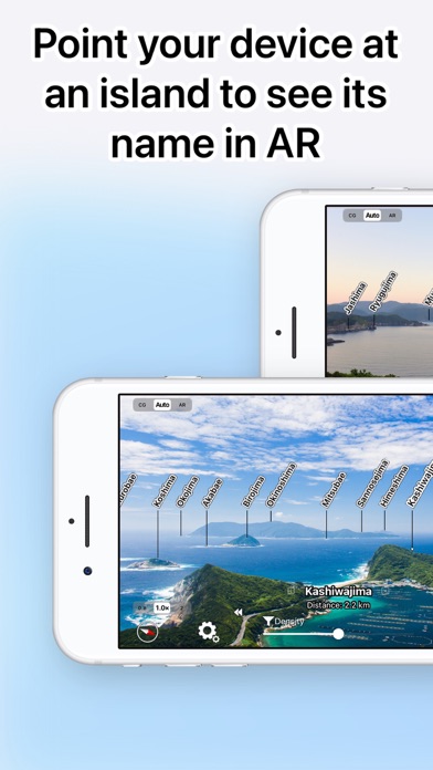
When you start the application and hold it over the island or coast, the name will be displayed in AR ・ The name of the island and the distance to the island are displayed. ・ It is displayed using 3D coordinates and a gyro sensor, so even if you look down from the sky or tilt the camera, the name will be displayed on the island so it is easy to check. ・ AR display works even if you are not connected to the Internet ・ You can check the AR display from any location specified on the map. ・ You can take a photo with the island name and share it by email. ・ The display position can be corrected by swiping the AR display up / down / left / right. ・ It is possible to correct the display position even after taking a picture. ・ All functions can be used for free * If the direction is not correct because the display is always north, remove the case or cover and try again. Metal or magnets on the case or cover may interfere with each other and cause malfunction. ■ Notes ・ Position may not be displayed correctly due to errors in GPS, gyro sensor, and electronic compass. -When used inside buildings, in trains, cars, near electric wires, metal fences, etc., correct information may not be obtained from GPS or electronic compass and may not be displayed correctly. ■Terms of Service https://www.apple.com/legal/internet-services/itunes/dev/stdeula/
What's new · 3.21
Improved the user interface. Updated the libraries in use. Fixed other minor issues.
Details