

Topo Maps US
DC Cloud Apps, LLC · Navigation
Independent analytics for this App Store listing. AppTracker is not affiliated with DC Cloud Apps, LLC.
Chart standing · US
What changed · US
Listing changes AppTracker has observed for this app in this storefront — new versions, price moves, rating shifts, and store copy.
• Recording stops when you start driving. Finish a hike or ride and drive off, and the app notices, sends a notification with Stop and Keep Recording options, and trims the drive from the saved trail. Turn it off in Settings if you prefer. • Trim drives from older trails. Open a trail that ends with a drive home and the app offers to remove it. • Cut a trail anywhere. Scrub along the elevation profile and tap the scissors to drop everything before or after that point. • Save polyline measurements as trails, not just freeform ones. • Elevation profiles for imported routes and saved measurements now follow the terrain between widely spaced points instead of drawing a straight line. • Fixes for flags that never got an elevation, plus memory and stability improvements.
Price & rating history · US
Reconstructed from the listing changes AppTracker has observed in this storefront. A field is charted once it has changed more than once, and each line starts at the value it moved from.
Average rating · ★ 4.43 now · 5 changes on record
Ratings breakdown · US
The star breakdown behind this app's rating in this storefront.
In-app purchases · US
No in-app purchases.
Screenshots




About
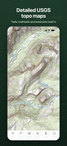
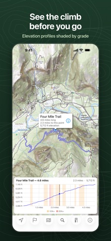
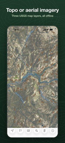
Download USGS topographic maps of the United States and use them offline, with no account and no subscription. Topo Maps US is built for people who go where cell service doesn't: hikers, backpackers, hunters, anglers, paddlers, mountain bikers, geocachers, and anyone who wants a real topographic map in their pocket. MAPS Choose from three USGS map layers: standard topographic, aerial imagery with a topographic overlay, or plain aerial imagery. OFFLINE Tap the map squares you want and download them before you leave. Downloaded maps work with no Internet connection and use no cell data in the field. TRAILS AND POINTS OF INTEREST BUILT IN Every map download includes the trails, summits, lakes, campsites, and other named places in that area from OpenStreetMap, so you can search them by name while you're offline. TRAIL RECORDING Record where you go. Recorded trails show your path on the map with distance, elapsed time, and average speed. Recording stops automatically when you start driving, and any drive at the start or end of a trail is trimmed off. ELEVATION PROFILES Every recorded or imported trail gets an elevation profile with distance labels and color-coded grade shading. Drag along the chart to see the matching point on the map, its elevation, and the time you passed it. FLAGS Mark your current location or any spot on the map. Flags record coordinates and elevation, and you can add notes and organize them by color: geocaches, trailheads, summits, camps, and so on. NAVIGATION Pick a flag and follow the direction arrow, driven by your compass heading, with the distance remaining. Handy for geocaching and for finding your way back to camp or the car. LOCATION See where you are on the map, your elevation, speed, and the accuracy of the GPS fix. MEASURE Trace a route on the map to measure its distance, then save it as a trail to follow later. IMPORT AND SHARE Import trails and waypoints from GPX files and geocache LOC files. Share your flags and trails by email, Messages, or AirDrop as standard GPX files that work with any GPS unit or mapping software. Back up your maps and data to a computer over Wi-Fi. Designed for iPhone and iPad. Note: Continued use of GPS in the background can noticeably reduce battery life.
What's new · 6.8
• Recording stops when you start driving. Finish a hike or ride and drive off, and the app notices, sends a notification with Stop and Keep Recording options, and trims the drive from the saved trail. Turn it off in Settings if you prefer. • Trim drives from older trails. Open a trail that ends with a drive home and the app offers to remove it. • Cut a trail anywhere. Scrub along the elevation profile and tap the scissors to drop everything before or after that point. • Save polyline measurements as trails, not just freeform ones. • Elevation profiles for imported routes and saved measurements now follow the terrain between widely spaced points instead of drawing a straight line. • Fixes for flags that never got an elevation, plus memory and stability improvements.
Details