

Route Scout - GPS Topo Mapper
Joseph Bartels · Navigation
Independent analytics for this App Store listing. AppTracker is not affiliated with Joseph Bartels.
Chart standing · US
What changed · US
Listing changes AppTracker has observed for this app in this storefront — new versions, price moves, rating shifts, and store copy.
• Fixed a bug that deleted all created waypoints on the second Pause/Resume • Drive now lets you choose your navigation app • Drag one finger along the elevation profile to move the map to that spot • Auto Sync is faster and more reliable, and Sync All works again • Stability fixes for recording, Proceed To, and offline maps
Price & rating history · US
Reconstructed from the listing changes AppTracker has observed in this storefront. A field is charted once it has changed more than once, and each line starts at the value it moved from.
Average rating · ★ 4.38 now · 4 changes on record
Ratings breakdown · US
The star breakdown behind this app's rating in this storefront.
Screenshots


About
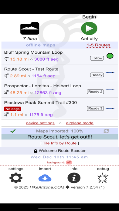
Record outdoor activities. Designed for hiking. Route Scout maps where you went, shows you where you are, and talks to you while you hike, so your phone can stay in your pocket. RECORD • Topo map with live miles, elevation gain, speed, moving average, time, and breaks • 40+ activity types: hike, backpack, trail run, mountain bike, horseback, snowshoe, kayak, canyoneering, 4x4 and more • Drop waypoints as you go: junctions, summits, water sources, trip notes • Splits Review: a per-mile table of time, pace, gain and accumulated gain • Keeps recording in the background with the screen off LISTEN INSTEAD OF LOOKING Route Scout speaks. Every announcement is optional. • Split statistics every quarter, half or full mile • Nature calls: a bird or animal sound cues each split, followed by a few facts about the animal you just heard • Off-trail alert tells you how far off you are and which direction back, then chimes when you return • Waypoints announced as you approach them • Break started, break over, low battery, and a chime when you are back at the trailhead • Adjustable speech speed; lower or silence other audio while it plays FOLLOW A ROUTE • Direct GPX import: the last route imported is set to "Follow" automatically • Offline topo maps download for that route, so navigation works with no signal • Pin any track to pursue for miles-to-go and off-track alerts • Back to Start builds a return route from what you have already recorded • Layers: HAZ Topo/Street, Satellite, and a U.S. land owner layer showing BLM, Forest Service, State Trust and private boundaries KNOW WHERE YOU ARE • Peak Scope names the summits around you with bearing, distance, and elevation • Compass • Nearby Routes pulls community-recorded routes around your location • Weather forecast and radar MANAGE YOUR ROUTES • Rename, merge, reverse, recolor, edit, and archive • Sort by recent, A-Z, or nearest • Settings sync across devices; reinstall, sign in, and settings come back NOW IN SIX LANGUAGES English, Spanish, French, German, Portuguese (Brazil), and Japanese; on screen and spoken aloud. Warning: never rely on a single means of navigation if your life depends on it. Notice: Continued use of GPS running in the background can dramatically decrease battery life.
What's new · 7.5.18
• Fixed a bug that deleted all created waypoints on the second Pause/Resume • Drive now lets you choose your navigation app • Drag one finger along the elevation profile to move the map to that spot • Auto Sync is faster and more reliable, and Sync All works again • Stability fixes for recording, Proceed To, and offline maps
Details